
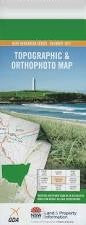
NSW 8928-4S
Wingello
Digital Products: You will receive an email shortly after checkout containing links to download your products.
If you do not receive this email within 30min, please check your Junk / SPAM email folder, prior to contacting us.
Description
This Topographic Map is produced by the New South Wales Government.
This map is supplied in digital in PDF format, which means it can be printed at home or sent to a professional printer for a 100% scale reproduction.
At this scale, 4cm on this map represents 1km on the ground. A standard map (which is square) covers an area of approximately about 12.5km by 12.5km, with a contour interval of 10m. This map contains natural and constructed features including road and rail infrastructure, vegetation, hydrography, contours, localities and some administrative boundaries.
Marulan Wingello Back Creek Ballanya Ballanya Hill Barber Barbers Creek Baronga Creek Dairy Flood Freestone Georges Creek Glenrock Glenrock Falls Gulf Creek Hanging Rock Swamp Jaorimin Creek Joe The Marines Folly Creek Joariwa Creek Marulan Creek Marulan Post Office Marulan Public School Marulan Railway Station Medway Junction Mooroowoolen Mundego Swamp Murphy Murrimba Ottawa Creek Oven Swamp Creek Paddys River Patricks River Penrose Penrose Public School Penrose Railway Station Penrose State Forest Plantation Gully Running Creek Shepherd Sugarloaf Hill The Sugar Loaf Tallong Tallong Public School Tallong Railway Station Tallowa Gorge Tallowa Gully Tangarang Creek Twin Uringalla Uringalla Creek Warrima Wildfire Gully Wingello Forest Wingello Public School Wingello Railway Station Wingello Reserve Wingello State Forest Woolshed Creek Bull Point Creek Bull Point Gully Bumballa Casburn Park Stingray Swamp Stingray Swamp Flora Reserve Hanging Rock Penrose South Tahalla