
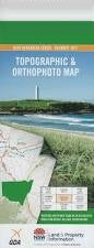
NSW 9028-4S
Kangaroo Valley
Digital Products: You will receive an email shortly after checkout containing links to download your products.
If you do not receive this email within 30min, please check your Junk / SPAM email folder, prior to contacting us.
Description
This Topographic Map is produced by the New South Wales Government.
This map is supplied in digital in PDF format, which means it can be printed at home or sent to a professional printer for a 100% scale reproduction.
At this scale, 4cm on this map represents 1km on the ground. A standard map (which is square) covers an area of approximately about 12.5km by 12.5km, with a contour interval of 10m. This map contains natural and constructed features including road and rail infrastructure, vegetation, hydrography, contours, localities and some administrative boundaries.
Kangaroo Valley Barangary Creek Barrengarry Barrengarry Creek Barrengarry Pass Barren Grounds Barren Grounds Fauna Reserve Barren Grounds Nature Reserve Belmore Falls Belmore Lookout Blakemans Lookout Brogers Creek Brogers Creek Tributary Broughton Broughton Head Broughton Mill Creek Broughton Vale Budderoo Budderoo Creek Budderoo National Park Cabbage Tree Gully Cambewarra Cooks Nose Cooks Nose Pass Coopers Gully Coxs Pass Denners Pass Ebbs Pass Faulks Pass Flying Fox Pass Fox Fox Defence Frys Creek Gerringong Falls Gerringong Creek Hansens Pass Hindmarsh Lookout Hindmarsh Pass Hindmarsh Ridge Illawarra Lookout Jamberoo Jamberoo Pass Kangaroo Ridge Kangaroo River Kangaroo Valley Cemetery Kangaroo Valley Public School Keenans Pass Cabbage Tree Creek Coopers Creek Geringong Creek Kangaroo Range Kings Creek Kings Gully Kings Hill Range Kings Ridge Lamonds Creek Mcandrews Gap Mcevilly Lookout Majors Creek Majors Gully Mannings Gully Mannings Lookout Maynards Falls Millers Creek Minnamurra Falls Minnamurra Falls Reserve Missingham Pass Myra Hill Myra Vale Myra Mountain Myrtle Creek Myrtle Gully Nelsons Creek Osborne Osborne Park Osbornes Pass Paddys Pass Pheasants Brush Creek Powerline Pass Redbank Gully Ryders Creek Saddleback Snake Gully Stony Creek Tanners Creek Target Creek Tomlins Hill Trimbles Creek Ulrichs Pass Upper Kangaroo River Upper Kangaroo Valley Wallangunda Creek Wallaya Walshs Pass Wattamolla Watts Hill Wildes Meadow Wildes Meadow Swamp Wonga Falls Woodhill Yarrawa Yarrawa State Forest Yeola Dhruwalgha Mountain Dodds Lagoon Dodds Pass Drawing Room Rocks Bunkers Hill Burra Creek Butter Track Pass Carrington Falls Binya Hill Les Lambert Lookout Blue Gum Reserve Kokoda Wildfire Carrington Barangary Cabbage Tree Blackmans Falls Burrawang Creek Colewood Tates Range Rocky Creek McAndrews Gap Laurel Bank Nugents Creek Sawyer Creek Foxground Creek