
NSW 8325-1N
Wymah
Digital Products: You will receive an email shortly after checkout containing links to download your products.
If you do not receive this email within 30min, please check your Junk / SPAM email folder, prior to contacting us.
Description
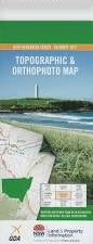
This Topographic Map is produced by the New South Wales Government.
This map is supplied in digital in PDF format, which means it can be printed at home or sent to a professional printer for a 100% scale reproduction.
At this scale, 4cm on this map represents 1km on the ground. A standard map (which is square) covers an area of approximately about 12.5km by 12.5km, with a contour interval of 10m. This map contains natural and constructed features including road and rail infrastructure, vegetation, hydrography, contours, localities and some administrative boundaries.
Meath Park Wymah Bungil Bungil East Cottontree Creek Flaggy Creek Granya Granya Fire Station Granya Primary School Granya Public Hall Hores Hill Jimmey Creek McGrath Recreation Ground Mount Firebrace Mount Lawson Murray Arm Stockyard Creek Koetong Creek