
QLD 6653
QLD 6653
Digital Products: You will receive an email shortly after checkout containing links to download your products.
If you do not receive this email within 30min, please check your Junk / SPAM email folder, prior to contacting us.
Description
This Topographic Map is produced by the Department of Natural Resources and Mines (DNRM), part of the Queensland Government.
This product is continously updated with the latest information available. New editions are generally published in Oct/Nov each year, however minor updates are constantly being included.
DNRM maps are produced automatically by computers, with minimal human oversight; so some duplication of information and occasional minor cartographic inconsistencies can be found.
The PDF version of this can be printed at home or sent to a professional printer for a 100% scale reproduction.
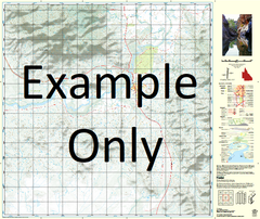
At this scale, 1cm on this map represents 1km on the ground. A standard map (which is square) covers an area of approximately 54km by 54km, with a contour interval of 20m. This map contains natural and constructed features including road and rail infrastructure, vegetation, hydrography, contours, localities and some administrative boundaries.
Jimboola Linda Downs Ancrum Bakers Lagoon Balfron Balmaha Bannockburn Creek Blue Mountain Borthwick Carrandotta Dary Dead Mans Corner Digmans Waterhole Endri Fifteen Mile Creek Four Mile Creek Galbally Grindstone Waterhole Hobkirk Horse Creek Lake Katherine Lemo Waterhole Linda Corner Manner Creek Marbles Bend McCabe Knob Mindyalla Creek Moonah Creek Mungala Waterhole Orange Creek Oxnam Quita Creek Racecourse Creek Sandy Creek Seventeen Mile Creek Six Mile Waterhole Smokey Waterhole Southdean St Ronan Creek Tickita Tickita Waterhole Walbo Waterhole Wampee Creek Waukaba Waterhole Saint Ronans Creek Carandotta Number Three Bore Split Creek Number Two Dam Roxborough Downs