
QLD 6761
QLD 6761
Digital Products: You will receive an email shortly after checkout containing links to download your products.
If you do not receive this email within 30min, please check your Junk / SPAM email folder, prior to contacting us.
Description
This Topographic Map is produced by the Department of Natural Resources and Mines (DNRM), part of the Queensland Government.
This product is continously updated with the latest information available. New editions are generally published in Oct/Nov each year, however minor updates are constantly being included.
DNRM maps are produced automatically by computers, with minimal human oversight; so some duplication of information and occasional minor cartographic inconsistencies can be found.
The PDF version of this can be printed at home or sent to a professional printer for a 100% scale reproduction.
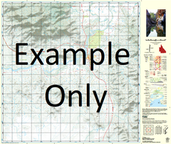
At this scale, 1cm on this map represents 1km on the ground. A standard map (which is square) covers an area of approximately 54km by 54km, with a contour interval of 20m. This map contains natural and constructed features including road and rail infrastructure, vegetation, hydrography, contours, localities and some administrative boundaries.
Brinawa Almora Archie Creek Barkly Barkly Swamp Beames Brook Yard Blacks Gully Blowhole Waterhole Bluebush Swamp Brasenose Brookdale Bull Creek Doab Elizabeth Creek Ferdinand Four Mile Creek Gum Waterhole Ladysmith Lawn Hill Creek Macadam Creek Millers Creek Newring Pandanus Waterhole Pelican Waterhole Planet Downs Punjaub Ravi Running Creek Sand Waterhole Sandhole Yards Sandy Creek Touchstone Tozer Creek Tozer Yard Twenty Mile Hut Watsons Camp Waterhole Willis Waterhole Willis Yard Burke Pelican Lagoon Watsons Hole Bore Lawn Hill Bore Dinner Camp Waterhole Gum Hole Waterhole Kunkulla Blow Hole Waterhole