
QLD 6764
QLD 6764
Digital Products: You will receive an email shortly after checkout containing links to download your products.
If you do not receive this email within 30min, please check your Junk / SPAM email folder, prior to contacting us.
Description
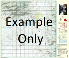
This Topographic Map is produced by the Department of Natural Resources and Mines (DNRM), part of the Queensland Government.
This product is continously updated with the latest information available. New editions are generally published in Oct/Nov each year, however minor updates are constantly being included.
DNRM maps are produced automatically by computers, with minimal human oversight; so some duplication of information and occasional minor cartographic inconsistencies can be found.
The PDF version of this can be printed at home or sent to a professional printer for a 100% scale reproduction.
At this scale, 1cm on this map represents 1km on the ground. A standard map (which is square) covers an area of approximately 54km by 54km, with a contour interval of 20m. This map contains natural and constructed features including road and rail infrastructure, vegetation, hydrography, contours, localities and some administrative boundaries.
Mornington Gununa Andrew Island Appel Channel Archies Creek Ballast Creek Bayley Island Bayley Point Beahgoo Island Beche De Mer Bay Beche De Mer Point Beeberr Creek Bendigo Waterhole Bidgagun Bay Bilmagun Point Boogorgun Spring Boyorrunga Inlet Brookes Reef Denham Island Dougherty Bay Douglas Island Dubbar Point Dugong River Dungnoreah Point Dwenty Point Forsyth Forsyth Island Forsyth Islands Gee Wee Creek Gee Wee Point Gerrigroo Point Goojamun Creek Government Bay Government Point Greenaway Point Gumbannge Point Gununa Horse Place Creek Horseshoe Island Ivis Island Jidan Marun Jirke Island Jubuneah Point Kungunmeah River Lelkajindi Creek Lingele Point Lingeleah Island Little Allen Island Midbagar Point Mornington Mornington Island Ngawalgeah Point Ngulwonmeah River Nithalan Creek Oaktree Point Pains Island Parker Porpoise Point Snapper Point Sydney Island Syrell Creek Timber Point Toongoowahgun Inlet Ttooldalin Waterhole Tulburrerr Island Waddagun Waterhole Walbor Inlet Warahbah Point Weediah Bay Wellesley Islands Whale Point Wonongung Waterhole Woolgunjin Point Wunungun Point Yuwah Point West Wellesley Islands Baldy Head Point Ngulwange River Humbug Point Roogorgun Spring Dwenty Gubungura Spring Point Ngawalge Point Gee Wee Gold Cliff Mornington Mission Mornington Island Mission Station Mornington Mission Station Wellesley Isles Dockety Bay Andrews Island Schnapper Point Beche de Mer Point Francis Island Robert Island South Wellesley Islands