
QLD 6851
QLD 6851
Digital Products: You will receive an email shortly after checkout containing links to download your products.
If you do not receive this email within 30min, please check your Junk / SPAM email folder, prior to contacting us.
Description
This Topographic Map is produced by the Department of Natural Resources and Mines (DNRM), part of the Queensland Government.
This product is continously updated with the latest information available. New editions are generally published in Oct/Nov each year, however minor updates are constantly being included.
DNRM maps are produced automatically by computers, with minimal human oversight; so some duplication of information and occasional minor cartographic inconsistencies can be found.
The PDF version of this can be printed at home or sent to a professional printer for a 100% scale reproduction.
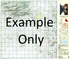
At this scale, 1cm on this map represents 1km on the ground. A standard map (which is square) covers an area of approximately 54km by 54km, with a contour interval of 20m. This map contains natural and constructed features including road and rail infrastructure, vegetation, hydrography, contours, localities and some administrative boundaries.
Montagu Downs Mudgeacca Ambrose Beechworth Bengeacca Creek Boomerang Waterhole Bucket Creek Burke River Canary Creek Cooridgee Water Facility Dam Creek David Five Mile Creek Four Mile Creek Four Mile Yard Gidya Creek Hamilton Yard Hilary Creek Jonathan Kasouka Lewis Lagoon Mackinnon Marion Downs Matchee Yard Milkamungra Waterhole Narrah Waterhole Nine Mile Creek Old Hamilton Yard Old Station Creek Paravituari Waterhole Pigeon Waterhole Thetford Twelve Mile Waterhole Wanderer Waterhole Yarlow Waterhole Yellow Waterhole Mantagu Downs Paravituan Waterhole Wireless Bore Robinsons Bore Paddock Bore Wanderer Water Bore Hamilton River Georgina River Herbert River