
QLD 6856
QLD 6856
Digital Products: You will receive an email shortly after checkout containing links to download your products.
If you do not receive this email within 30min, please check your Junk / SPAM email folder, prior to contacting us.
Description
This Topographic Map is produced by the Department of Natural Resources and Mines (DNRM), part of the Queensland Government.
This product is continously updated with the latest information available. New editions are generally published in Oct/Nov each year, however minor updates are constantly being included.
DNRM maps are produced automatically by computers, with minimal human oversight; so some duplication of information and occasional minor cartographic inconsistencies can be found.
The PDF version of this can be printed at home or sent to a professional printer for a 100% scale reproduction.
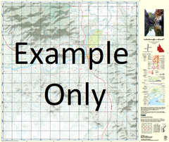
At this scale, 1cm on this map represents 1km on the ground. A standard map (which is square) covers an area of approximately 54km by 54km, with a contour interval of 20m. This map contains natural and constructed features including road and rail infrastructure, vegetation, hydrography, contours, localities and some administrative boundaries.
West Leichhardt Argylla Argylla Creek Ballara Black Angel Gorge Breakaway Creek Brown Creek Brumby Creek Brush Cattle Creek Charley Creek Coll Dam Creek Deighton Pass Dingo Creek Duffers Creek Edna May Creek Fountain Spring Gin Creek Gorge Creek Greens Creek Gum Creek Haslingden Heywood Hightville Hutchinson Creek Lagoon Creek Leichhardt RiverEast Branch Little Brumby Creek Little Greens Creek Little Rocky Creek Mount Macarthur Magazine Creek Malbon Mary Kathleen Lake Mary Kathleen Melba Hole Lake Moondarra Mull Oldman Crossing Parkside Mount Philp Pot Hole Creek Red Bean Creek Richards Creek Rifle Creek Rocky Creek Rocky Waterhole Rosebud Rotary Hill Spear Creek Split Rock Waterhole Spring Creek Steele Stockyard Creek Stony Creek Sybella Creek The Three Sisters Warrigal Creek Warrigal Waterhole White Blow Hill Yarraman Creek Breakaway Fisher Healy Sunset Pioneer Townview Wonga Gorge Shovel Creek Black Angle Gorge Browns Creek Wee Macgregor Mines Pothole Creek Read Creek