
QLD 6862
QLD 6862
Digital Products: You will receive an email shortly after checkout containing links to download your products.
If you do not receive this email within 30min, please check your Junk / SPAM email folder, prior to contacting us.
Description
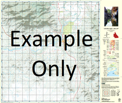
This Topographic Map is produced by the Department of Natural Resources and Mines (DNRM), part of the Queensland Government.
This product is continously updated with the latest information available. New editions are generally published in Oct/Nov each year, however minor updates are constantly being included.
DNRM maps are produced automatically by computers, with minimal human oversight; so some duplication of information and occasional minor cartographic inconsistencies can be found.
The PDF version of this can be printed at home or sent to a professional printer for a 100% scale reproduction.
At this scale, 1cm on this map represents 1km on the ground. A standard map (which is square) covers an area of approximately 54km by 54km, with a contour interval of 20m. This map contains natural and constructed features including road and rail infrastructure, vegetation, hydrography, contours, localities and some administrative boundaries.
Yarrum Burketown Albert River Andiah Armraynald Billygoat Lagoon Blue Bush Watercourse Bohemia Waterhole Buffalo Swamp Bullock Waterhole Burke Cadell Landing Crooked Creek Crooky Creek Dingo Waterhole Dinner Creek Disaster Inlet Fareham Finucane Island Gaynor Goose Lagoon Gore Point Harris Creek Harris Lake Hobble Chain Creek Honeymoon Lagoon Horseshoe Bend Johnnie Creek Jones Island Judy Lagoon Kangaroo Point Kateyford Lagoon Creek Landsborough Inlet Last Hope Waterhole Leichhardt River Millar Creek Millars Point Waterhole Millar Mooboor Nicholson River Old Station Lagoon Pandanus Creek Pandanus Ridge Pasco Inlet Pear Tree Waterhole Harris Creek Saltwater Arm Sandy Creek Six Miles Rocks The Lake Timor Timor Lagoon Truganini Landing Victoria Rocks Williams Inlet Woody Creek Woolshed Waterhole Yellow Waterhole Pascoe Inlet Stokes Point The Ballast Grounds Johnnies Plain Jerrys Lagoon Dinner Creek Bore Judys Lagoon Millers Point Waterhole Armraynald Bore