
QLD 6952
QLD 6952
Digital Products: You will receive an email shortly after checkout containing links to download your products.
If you do not receive this email within 30min, please check your Junk / SPAM email folder, prior to contacting us.
Description
This Topographic Map is produced by the Department of Natural Resources and Mines (DNRM), part of the Queensland Government.
This product is continously updated with the latest information available. New editions are generally published in Oct/Nov each year, however minor updates are constantly being included.
DNRM maps are produced automatically by computers, with minimal human oversight; so some duplication of information and occasional minor cartographic inconsistencies can be found.
The PDF version of this can be printed at home or sent to a professional printer for a 100% scale reproduction.
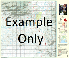
At this scale, 1cm on this map represents 1km on the ground. A standard map (which is square) covers an area of approximately 54km by 54km, with a contour interval of 20m. This map contains natural and constructed features including road and rail infrastructure, vegetation, hydrography, contours, localities and some administrative boundaries.
Scarsdale Cazna Downs Strathelbiss Granton Macsland Balzac Barracks Hole Beantree Creek Bronte Bulla Bulla Waterhole Mount Datson Elrose Fifteen Mile Water Facility Five Mile Lagoon Goodwood Haworth Jibloo Waterhole Kane Soak Laurallen Mucklandama Creek Ninmaroo Ninmaroo Waterhole Mount Ninmaroo Paton Downs Paynton Downs Pierpont Ratcliffe Red Head Creek Six Mile Creek Sowpit Waterhole St Lucia Tolarno Mount Unbunmaroo Warenda Warenda Water Facility Wills Creek Black Mountain Bore Gum Creek Bore Laurallan Goppa Goppa Warenda Number Two Bore Old Warenda Goodwood Number Three Bore