
QLD 6957
QLD 6957
Digital Products: You will receive an email shortly after checkout containing links to download your products.
If you do not receive this email within 30min, please check your Junk / SPAM email folder, prior to contacting us.
Description
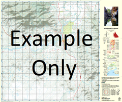
This Topographic Map is produced by the Department of Natural Resources and Mines (DNRM), part of the Queensland Government.
This product is continously updated with the latest information available. New editions are generally published in Oct/Nov each year, however minor updates are constantly being included.
DNRM maps are produced automatically by computers, with minimal human oversight; so some duplication of information and occasional minor cartographic inconsistencies can be found.
The PDF version of this can be printed at home or sent to a professional printer for a 100% scale reproduction.
At this scale, 1cm on this map represents 1km on the ground. A standard map (which is square) covers an area of approximately 54km by 54km, with a contour interval of 20m. This map contains natural and constructed features including road and rail infrastructure, vegetation, hydrography, contours, localities and some administrative boundaries.
Granada Lady Wallace Glen Isla Dipvale Alarcos Arthurs Hill Bannock Burn Bivrambla Blackfellow Waterhole Bony Creek Camel Rock Capsize Creek Centipede Creek Clayton Creek Cleanskin Creek Corella Delta Creek Devils Elbow Diorite Creek Donaldson Water Facility Euliwah Waterhole Evandean Granada Water Facility Gulliver Creek Hillside Horse Creek Jessievale Kajabbi Kings Waterehole Knapdale Koolamarra Koolamarra Water Facility Lady Clayre Creek Little Malakoff Creek Longamundi Waterhole Mount Maggie Malakoff Creek Mount Malakoff Manfred Downs Merkara Mount Godkin Range Mount Roseby Naraku Norcurry Nuchalis Ogorilla Creek One Tree Hill Palm Creek Pinnacle Creek Pinnacle Waterholes Portal Creek Prospector Creek Quamby Quamby Water Facility Mount Rose Bee Round Mountain Safir Sally Creek Skipness Tea-Tree Creek Urquhart Urquhart Creek Spider Creek Bauhina Well Bawooing Cabbage Tree Creek Marshalls Well Granada Well Holesworth Well Urs Tree Well Sandridge Well Wallace Corner Creek Bore Koolamarra Top Well Koolamara Top Well Koolamarra Lower Well Koolamara Lower Well Lady Wallace Well Lady Wallace Bore Tabletop Well Mail Change Well Kings Waterhole Meath Devils Own Well Venus Yambani Arthur Hill Mount Quamby Teatree Creek Cooroonyah Native Companion Well Middle Tommy Well Harry Creek Malakoff Bore The Long Waterhole Upper Tommy Well Cameron Creek Carsland Top Corella Well