
QLD 9546
QLD 9546
Digital Products: You will receive an email shortly after checkout containing links to download your products.
If you do not receive this email within 30min, please check your Junk / SPAM email folder, prior to contacting us.
Description
This Topographic Map is produced by the Department of Natural Resources and Mines (DNRM), part of the Queensland Government.
This product is continously updated with the latest information available. New editions are generally published in Oct/Nov each year, however minor updates are constantly being included.
DNRM maps are produced automatically by computers, with minimal human oversight; so some duplication of information and occasional minor cartographic inconsistencies can be found.
The PDF version of this can be printed at home or sent to a professional printer for a 100% scale reproduction.
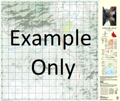
At this scale, 1cm on this map represents 1km on the ground. A standard map (which is square) covers an area of approximately 54km by 54km, with a contour interval of 20m. This map contains natural and constructed features including road and rail infrastructure, vegetation, hydrography, contours, localities and some administrative boundaries.
Rainbow Beach Tin Can Bay Eurong Lake Barga Beeliwa Lagoon Lake Benaroon Lake Birrabeen Boomanjin Airstrip Boomanjin Hill Lake Boomanjin Boronia Bridge Creek Cameron Creek Cameron Point Carland Creek Carlo Carlo Creek Carlo Island Carlo Point Cooloola Cooloola Coast Cooloola Creek Coolooloi Creek Dinnies Creek Double Island Point Eight Mile Rocks Elbow Point Eudlo Point Figtree Lake Freshwater Lake Geewan Creek Gerowweea Creek Govi Creek Griffen Creek Hook Point Ida Island Inskip Point Jabiru Swamp Lake Jennings Judd Point Markwells Spur Middle Bank Mullen Creek North Channel North Cooloola Point North Spit One Tree Rocks Pannikin Island Poona Lake Poverty Point Red Lagoon Searys Creek Semaphore Creek Sheep Station Lagoons Smooger Point Snapper Creek Snapper Point South Channel South Cooloola Point South Spit Pipeclay National Park Talboor Taleerba Creek Teebar Creek Teebean Point Teewah Creek Teewah Point The Bar The Bluff Tin Can Inlet Toolara Tooloora Creek Wide Bay Wide Bay Harbour Wolf Rock Woocoonba Lagoons Woolaan Yankee Jack Lake Tarwhine Point Fraser Island Maryborough City Double Island Point Conservation Park Great Sandy Strait Cooloola Shire Inskip Seventy-Five Mile Beach Lake Boemingen Walameboulha Lagoon Figtree Creek Snout Point South Bank Tin Can Creek Cherry Venture Store Creek