
QLD 9446-2
QLD 9446-2
Digital Products: You will receive an email shortly after checkout containing links to download your products.
If you do not receive this email within 30min, please check your Junk / SPAM email folder, prior to contacting us.
Description
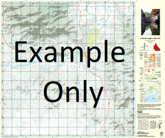
This Topographic Map is produced by the Department of Natural Resources and Mines (DNRM), part of the Queensland Government.
This product is continously updated with the latest information available. New editions are generally published in Oct/Nov each year, however minor updates are constantly being included.
DNRM maps are produced automatically by computers, with minimal human oversight; so some duplication of information and occasional minor cartographic inconsistencies can be found.
The PDF version of this can be printed at home or sent to a professional printer for a 100% scale reproduction.
At this scale, 2cm on this map represents 1km on the ground. A standard map (which is square) covers an area of approximately about 25km by 25km, with a contour interval of 10m. This map contains natural and constructed features including road and rail infrastructure, vegetation, hydrography, contours, localities and some administrative boundaries.
Cooloola Cove Tinnanbar Big Angle Black Swan Creek Browns Camp Browns Camp Creek Ching Island Cooloola Coast Coondoo Creek Cowra Cowra Point Dinna Creek Kangaroo Creek Kauri Creek Mosquito Creek Native Dog Creek Red Ridge Creek Sandy Creek Scrubber Creek Shark Inlet Sugarloaf Creek Tahiti The Red Bank Toolara Ulirrah Ulirrah Creek Kauri Creek Conservation Park Toolara Forest Tiaro Shire Tin Can Bay Cooloola Shire Tin Can Bay Tiaro Shire Wallu Neerdie Cooloola Shire Huon Mundy Creek Kuari Creek Toolara Forest