
QLD 9541-2
QLD 9541-2
Digital Products: You will receive an email shortly after checkout containing links to download your products.
If you do not receive this email within 30min, please check your Junk / SPAM email folder, prior to contacting us.
Description
This Topographic Map is produced by the Department of Natural Resources and Mines (DNRM), part of the Queensland Government.
This product is continously updated with the latest information available. New editions are generally published in Oct/Nov each year, however minor updates are constantly being included.
DNRM maps are produced automatically by computers, with minimal human oversight; so some duplication of information and occasional minor cartographic inconsistencies can be found.
The PDF version of this can be printed at home or sent to a professional printer for a 100% scale reproduction.
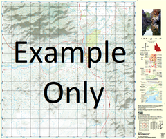
At this scale, 2cm on this map represents 1km on the ground. A standard map (which is square) covers an area of approximately about 25km by 25km, with a contour interval of 10m. This map contains natural and constructed features including road and rail infrastructure, vegetation, hydrography, contours, localities and some administrative boundaries.
Guineas Farm Rioqamore Braeside Mallaba Hillhaven Ophir Glen Rinadeena Centurion Park Wybalena Waverley Park Coral Grove Burringbar Fernvale Murwillumbah Tumbulgum Uki Bartlets Creek Bean Tree Crossing Boat Harbour Black Scrub Flora Reserve Black Scrub Blindmouth Creek Bray Park Bray Park Public School Breakfast Creek Breakfast Creek Picnic Area Breakfast Creek Reserve Brunswick River Cedar Creek Chillingham Public School Chinamans Hill Chowan Chowan Creek Mount Chowan Clifford Island Clothiers Creek Cockatoo Hill Commissioners Creek Condong Condong Creek Condong Public School Condong Range Coolamon Creek Couchy Creek Crabbes Creek Crabbes Creek Public School Crookes Valley Crystal Creek Crystal Creek Public School Cudgera Creek Dunbible Dunbible Creek Dunbible Railway Station Dungay Dungay Creek Dungay Public School Eungella Eviron Farrants Hill Fernvale Public School Five Ways Fosters Gully Glen Warning Gold Gully Gooninbar Happy Valley Hindmarsh Island Hopkins Creek Inner Pocket Jacksons Creek Johnsons Creek Chillingham Bridge Dalguigan Swamp The Gap Gold Creek Grass Tree Camp Mount Ivy Jerrys Creek Kielvale Kings Gully Knox Park Korrumbyn Creek Mount Kunghur Kynnumboon Lions Lookout Little Dulguigan Creek Lynchs Creek Public School Mcconnells Creek Mcconnells Gully Main Arm Main Arm of Brunswick River Main Trust Canal Main Trust Drain Marshalls Creek Mays Hill Mejean Creek Middle Arm of Brunswick River Middle Arm Tweed River Middle Pocket Midginbil Midginbil Public School Mount Misery Mooball Mooball Lagoon Mooball National Forest Mooball Public School Mooball Railway Station Mooball State Forest Mount Warning Mount Warning National Park Mount Warning State Park Murwillumbah Creek Murwillumbah East Public School Murwillumbah High School Murwillumbah Post Office Murwillumbah Public School Murwillumbah Railway Station Murwillumbah Technical College Nightcap National Forest Night Cap National Forest Nobby Creek Nobbys Creek Nobbys Creek Public School North Arm Brunswich River North Arm Tweed River North Tumbulgum Nullum Mount Nullum Numinbah Numinbah Creek Oxley River Palm Lea Palmvale Pat Smiths Creek Perch Creek Pine Log Creek Pipeclay Creek Rawson Island Red Cutting Reserve Creek Reserve Creek Public School Ritchies Creek Rocky Cutting Rolands Creek Rous River Sharps Crossing The Sisters Sleeping Lion Smiths Creek South Arm South Arm Tweed River Stokers Railway Station Stokers Siding Stokers Siding Platform Stokers Siding Public School Stony Creek Terragon Mount Terragon The Pocket The Pocket Public School Thomson Creek Thomson Gully Three Tops Tomewin Toolond Trust Canal Tumbulgum Public School Tygalgah Mount Uki Uki Oval Uki Public School Uki Sports Oval Upper Burringbar Upper Burringbar Public School Upper Burringbar Railway Station Upper Crystal Creek Upper Dungay Upper Duroby Upper Main Arm Upper Main Arm Public School Urliup Wardrop Valley Warning Hattons Bluff Wilsons Creek Wobul Creek Wollumbin Creek Mount Wollumbin Wollumbin State Forest Wooded Bluff Yelgun Dinseys Creek Dinseys Rock Zara Doon Doon Doon Doon Creek Doughboy Creek Dulguigan Dulguigan Creek Dulguigan Plain Dum Dum Doon Doon Public School Mount Dum Dum Burrell Burringbar State Forest Burringbar Creek Burringbar Gap Burringbar Lagoon Burringbar Public School Burringbar Railway Station Burringbar Range Byrrill Byrrill Ridge Chinamans Creek Clarrie Hall Dam Clothiers Creek Public School Fitzhenry Park Fowler Fitzhenry Memorial Park Frogs Hollow Johansen Creek Mckenzies Rock Murwillumbah Cemetery Murwillumbah General Cemetery Murwillumbah Showground Newell Park South Murwillumbah South Murwillumbah Public School The Rock Woodlands Creek Nunderi Rowlands Creek Bullamakanka Park Budd Park James Henry Williams Park Hartman Park Buckley Park Willward Park Charles Harold Lundberg Memorial Park Queens Park Amwil Park Dallis Park Tumbulgum Sportsground Quinn Family Park Tom O'Connors Reserve Gerald Parker Park Crams Farm Reserve Bluey Hill Park Hogans Park Warning Beacon Inner Pocket Nature Reserve Boydsville Barrie Smith Hockey Fields Charnocks Crossing Countryside Estate Eviron Rock Golden Links Estate Greenhills Hartigans Hill Reservoir Lucas Park Nicholl Park Oakbank Sacred Park Stan Sercombe Park Chillingham Kunghur Wollumbin Wollumbin School Bobs Lookout Mayal Creek Cudgenbil Waterhole Stotts Island North Arm Nullum State Forest Crooks Valley Byangum Skinner Lowes Wharf George Graham Crossing Graham Creek Garden of Eden Tenduragan Mount Thunberrigan Wyberba McPherson Range MacPherson Range Sphinx Lookout Stotts Creek Stotts Channel McLeods Creek Brooks Farm Pipe Clay Creek Dung Creek Doughboy Mountain Elm Pine Oak Bank Karrumbyn Creek Stoker Rollands Creek Byrrill Creek Tom OConnors Reserve Pelican Creek Graveyard Creek