
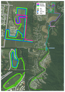
Fun Run Course Map
We put this map together to support a local charity Fun Run.
We channeled our love of the London Underground Transport Map, to show the courses that different distances would follow and how they overlap, run parellel, etc.
To give the runners more awareness of the course, and to help officials, we used Satellite Imagery as the background.
This was printed and displayed online.
