
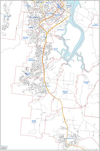
Street Map for Realesate Agent
We were approached by a local Realestate Agent to produce a big wall map for their office.
They wanted to be able to easily plot the locations of properties under their management, without the clutter that 'off the shelf' maps have.
The final product was print at over 2m tall, and has greatly improved the businesses oversight of rental and sale distribution.
Realestate sales and management is an area of business that can greatly benefit from geospatial services; as they say it is all about location, location, location... and that is exactly was geospatial analysis is.
Some applications for the realestate industry might be:
- Distance calculations from a property to key places (CBD, Shopping Centres, School) - these can be "as the crow flies" or more accurately distance by car.
- Distribution and representation of recent sale prices in the area
- Represent the profile of a neighborhood using ABS data sets (age, income, persons per household, etc)
- Noise Paths (roads, rail, aircraft)
- Overlays of school feeder areas and other services
All these offer ways to promote the benefits of a property for sale / lease, or to correctly price a property for sale (be it the buyer or seller).

