
Tour Maps for Cruise Ship
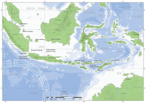
This was a challenging project, creating a series of Tour / Location maps for a company conducting Cruise Ship tours around Australia and SE Asia.
The style was developed with the client, to match their broader brand.
The difficulty was accurately identifying and plotting many of the places the ships visit - most of which have local names, but aren't necessarily recognised in gazettes.
Working with passage data from the ships, satellite imagery, very old maps (including some from the Second World War); we were able to accurately identify and name all the places of interest.
In all 6 maps were developed, and used by the client in online and print.
