
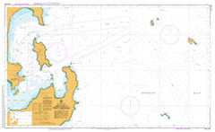
AUS 134
Approaches To Port Lincoln
Please note that all charts are nominally folded in half for storage and handling as per the marine industries standard.
If you require an unfolded copy (ie: flat for framing), please select Flat Paper, and we will organise a special print service to accomodate your request.
Description
This official Nautical Chart is produced by the Australian Hydrographic Office, and corrected fortnightly to 'Notice to Marines' by Cairns Charts & Maps. This ensures it remains compliance with Safety of Navigation requirements. This marine chart, or 'sea map', is primarily produced to support the safe navigation of commercial shipping through Australian, Papua New Guinea and Solomon Island waters.
Nautical charts depict the seabed, or bathymetry, using a variety of colours to shade the depth regions. Darker blues indicate shallower water, while light blues and white indicate deeper water. A chart will also show continuous contour lines (at varying intervals depending on the scale of the chart), 'spot depths' across the whole area, as well as different symbols indicating wrecks, shallow rocks and dangers, as well as details on lights, light houses, tides and currents.
For extensive detail on the symbology of nautical charts, the Symbols and Abbreviations used on Admiralty Charts is the definitive reference.
Port Lincoln Cape Colbert Kirton Point Post Office Helen Shoal Hawkers Devil Reef Mallee Park Nelson Square Stamford Hill Howard Rock Lincoln Marine Science Centre Boston Hill Ravendale Ovals Kernilla Axel Stenross Maritime Museum Kirton Oval Kirton Reserve Bass Shoal Kaitjaba Kirton Point Jetty Linklater Point Wellington Square Point Boston Karen Shoal Stinky Creek South Channel North Channel North Shields Primary School BHP Shipping Port Port Champagny Port de la Confiance Donington Reef Harbor of Port Lincoln Hawker Devil Brennan Jetty Ile Dego Ile Chaliou Point Fanny Bickers Islands Grantham Island Railway Jetty Proper Bay Sibsey Island Kangaroo Reef Punnu Mudla Engine Point Kallinjala Carcase Rock Town Jetty Stickney Island Kirton Point Davidson Rock Trummers Hut Dangerous Reef North Basin Cemetery Beach Port Lincoln East Post Office Port Lincoln West Post Office Ark Nicolette Shoal Billy Lights Point MacLaren Point Bruin Boston Island Cutting Grass Flat Port Lincoln Bulk Grain Terminal Picnic Beach Grantally Keal Hill Pillie Lake Ile Cerant Ile Clarke Port Lincoln Proper Ile Lagrange Horse Rock Boston Bay Cap Colbert McLaren Point Cape Donington Lighthouse Stony Point Punnumudla Flinders Monument Kuriljeli Kirton Point Caravan Park Penny Shoal William Henry Homestead Beach Bridget Shoal Sunken Brother Hawkers Devil Kirton Point Primary School Ile Suzanne Port Lincoln Proper Bay Squeaky Beach Rotten Bay Kate Le Hunte Shoal Port Lincoln Railway Station Cape Donington Port Lincolin Junior Primary School St Mary of the Angels School Port Lincoln High School Kallinyalla Snapper Rock Gundal Island Shelley Beach Lincoln Cove Marina Grantala Point Haselgrove Kurilyelli Port Lincoln Post Office Cap Bouguer Murray Point St Josephs School Jane Shoal Porter Bay Flinders Monument Trig Port Lincoln Lighthouse Port Lincoln South Post Office Centenary Oval Ile Victoire Port Lincoln Junior Primary School Donington Island Bicker Isles Port Lincoln Primary School Poole Oval Lions Picnic Spot Point Lincoln Lighthouse Surfleet Point Fisherman Point Spalding Cove Hayden Point Point Maria Dolphin Degerando Channel West Basin Scrubby Creek North Shields English Island Levi Island Nowland Shoal Boston Point Maria Point Shelly Beach Maclaren Point