
Aus ENC PT 406
Port Pack 406
ENC Subscriptions: On supplying the required information at checkout, your subscription will be processed with the Australian Hydrographic Office (AHO) the following business day. The AHO will then email you your permit files for loading into your system.
Description
This official collection of Electronic Navigation Charts is produced by the Australian Hydrographic Office. It conforms to S57 IHO Standards and requires an S63 compatible system to operate. ENC are primarily produced to support the safe navigation of commercial shipping, but are equally useful for recreational vessels. ENC can, when used on a Type approved system, replace the need for paper nautical charts.
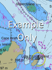
This AusENC packs contains all the Category 3, 4, 5 and 6 cells which overlap the area depicted in the map. The mapped area is based on the outer coverage of the category 5 and 6 cells within this pack. The category 3 and 4 cells not shown so as to avoid clutter. This pack does not include any category 1 or 2 cells.
For extensive detail on the symbology of nautical charts, the Admiralty Guide to ENC Symbols used in ECDIS is the definitive reference.
ENC Subscriptions
All AusENC packs are supplied as a subscription. This subscription gives you access to the updated information supplied by the Hydrographic Office throughout your subscription period.
Once your subscription is established, the Hydrographic Office will email you your permits (a small text file to load into your system), and then each fortnight will email you to advise if new permits need to be installed. This fortnightly email will also contain a link to the latest updates available.
Nearing the end of your subscription, we will contact you directly to confirm your requirements for a further renewal. You may also receive similar alerts from the Hydrographic Office.
AU130120 AU220140 AU130120 AU220140 AU417145 AU418145 AU5262X4 AU6CNS01 AU6CNS02 AU130120 AU220140 AU417145 AU418145 AU5262X4 AU6CNS01 AU6CNS02 AU130120 AU220140 AU417145 AU5262X4 AU6CNS01 AU6CNS02 AU130120 AU220140 AU417145 AU418145 AU5262X4 AU6CNS01 AU6CNS02 AU130120 AU220140 AU130120 AU130120 AU130120 AU130120 AU220140 AU130120 AU220140 AU417145 AU5262X4 AU6CNS01 AU6CNS02 AU417145AU130120 AU220140 AU130120 AU220140 AU417145 AU5262X4 AU6CNS01 AU6CNS02 AU130120 AU220140 AU417145 AU5262X4 AU6CNS01 AU6CNS02 AU130120 AU220140 AU417145 AU5262X4 AU6CNS01 AU6CNS02 AU130120 AU220140 AU417145 AU5262X4 AU6CNS01 AU6CNS02 AU130120 AU220140 AU130120 AU130120 AU130120 AU130120 AU220140 AU130120 AU220140 AU417145 AU5262X4 AU6CNS01 AU6CNS02 AU417145AU130120 AU220140 AU130120 AU220140 AU417145 AU5262X4 AU6CNS01 AU6CNS02 AU130120 AU220140 AU417145 AU5262X4 AU6CNS01 AU6CNS02 AU130120 AU220140 AU417145 AU5262X4 AU6CNS01 AU6CNS02 AU130120 AU220140 AU417145 AU5262X4 AU6CNS01 AU6CNS02 AU130120 AU220140 AU130120 AU130120 AU130120 AU130120 AU220140 AU130120 AU220140 AU417145 AU5262X4 AU6CNS01 AU6CNS02 AU417145
Cairns Yarrabah Admiralty Island Aeroglen Alligator Creek Barr Creek Barron Beach Barron River Bessie Falls Bessie Point Blackfellows Creek Boughtons Creek Brinsmead Gap Brown Bay Brown Creek Bullburra Beach Bungalow Cairns Harbour Cairns North Campbells Lookout Cassowary Creek Casuarina Point Chinaman Creek Clarkes Creek Cowley Creek Crowleys Creek Deception Point Ellie Point Falls Creek False Cape Fitzalan Creek George Creek Giangurra Gordon Creek Mount Gorton Cape Grafton Grant Hill Hamliffe Creek Hills Creek Kappa Creek King Beach Koombal Lily Creek Little Pine Creek Little Turtle Bay Lumley Hill Lyons Point Mackey Creek May Peak Mick Creek Mission Bay Murray Prior Range Mount Murray Prior Nares Nisbet Range Oombunghi Oombunghi Beach Oombunghi Creek Palm Beach Picnic Hill Pine Creek Redbank Creek Redden Creek Richter Creek Rocky Island Rolling Bay Sawpit Gully Second Beach Seelee Creek Skeleton Creek Smiths Creek Stafford Point Stratford Siding Sturt Cove Sunny Bay Thomatis Creek Trinity Trinity Inlet Turtle Bay Wahday Creek White Rock White Rock Peak Whites Gap Whitfield Range Mount Whitfield Wide Bay Woree Wrights Creek Yarrabah Beach Mount Yarrabah Yorkeys Creek Yorkeys Knob Yorkeys Point Anderson Street Conservation Park Mount Whitfield Conservation Park Machans Beach Holloways Beach Gunjurra Island Gaviolis Hill Middle Creek Saltwater Creek Trinity Forest Reserve Bayview Heights Brinsmead Cairns City Earlville East Trinity Edge Hill Glen Boughton Kanimbla Manoora Manunda Mooroobool Mount Sheridan Parramatta Park Portsmith Stratford Westcourt White Rock Cairns Regional Council Whitfield Smithfield Creek Holloway Beach Bulburra Beach Freshwater Cairns International Airport Little Barron River Gribble Point LittleTurtle Bay Yarrabah Aboriginal Community Yarrabah Mission Magazine Creek Senrab Point Mooroobool Peak Firewood Creek Trinity Island Waddlebla Peak Oombunchi Beach Queerah Wright Creek Bessie Point Brown Bay Giangurra Lyons Point Mick Creek Rolling Bay Second Beach Sturt Cove Nares Trinity Inlet Stafford Point Alligator Creek Magazine Creek