
Aus ENC PT 409
Port Pack 409
ENC Subscriptions: On supplying the required information at checkout, your subscription will be processed with the Australian Hydrographic Office (AHO) the following business day. The AHO will then email you your permit files for loading into your system.
Description
This official collection of Electronic Navigation Charts is produced by the Australian Hydrographic Office. It conforms to S57 IHO Standards and requires an S63 compatible system to operate. ENC are primarily produced to support the safe navigation of commercial shipping, but are equally useful for recreational vessels. ENC can, when used on a Type approved system, replace the need for paper nautical charts.
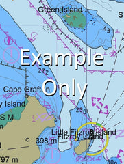
This AusENC packs contains all the Category 3, 4, 5 and 6 cells which overlap the area depicted in the map. The mapped area is based on the outer coverage of the category 5 and 6 cells within this pack. The category 3 and 4 cells not shown so as to avoid clutter. This pack does not include any category 1 or 2 cells.
For extensive detail on the symbology of nautical charts, the Admiralty Guide to ENC Symbols used in ECDIS is the definitive reference.
ENC Subscriptions
All AusENC packs are supplied as a subscription. This subscription gives you access to the updated information supplied by the Hydrographic Office throughout your subscription period.
Once your subscription is established, the Hydrographic Office will email you your permits (a small text file to load into your system), and then each fortnight will email you to advise if new permits need to be installed. This fortnightly email will also contain a link to the latest updates available.
Nearing the end of your subscription, we will contact you directly to confirm your requirements for a further renewal. You may also receive similar alerts from the Hydrographic Office.
AU130150 AU230150 AU424151 AU5245X6 AU130150 AU230150 AU424151 AU425151 AU5245X6 AU130150 AU130150 AU230150 AU130150 AU230150 AU424151 AU425151 AU5245X6 AU130150 AU230150 AU424151 AU425151 AU5245X6 AU130150 AU424151 AU5245X6 AU424151
Woodcot Tidalmaree Edwards Clifton Farm Calliope Gladstone Tannum Sands Southend Benaraby Auckland Auckland Creek Auckland Hill Auckland Inlet Auckland Point Auckland Point Reef Badjin Creek Bangalee Barney Point Mount Beecher Bells Gully Biondello Birkenhead Blind Creek Boat Creek Boatshed Point Boyne Boyne Island Boyne River Bray Hills Briffney Creek Burua Bushy Island Byellee Callemondah Calligooran Creek Calliope Crossing Calliope River Camp Island Canoe Point Carthurbie Creek Casuarina Clump Cattle Creek Centre Creek Chinaman Island Clarke Creek Clinton Clinton Park Clyde Creek Cogoa Creek Compigne Channel Compigne Island Creek Rocks Curtis Curtis Rock Port Curtis Datum Point Devils Elbow Diamantina Island East Banks East Point East Point Ledge East Stowe Elizabeth Peak Endfield Creek Entrance Ledge Ethel Rock Facing Channel Facing Island Farmers Island Farmers Point Farmers Reef Fishermans Landing Flora Point Four Mile Creek Friend Point Garden Island Gatcombe Gatcombe Channel Gatcombe Head Ginger Beer Creek Golding Graham Grass Point Gravel Creek Grayson Greens Creek Hamilton Point Hay Island Hetherington Hummock Hill Iveragh Jenny Lind Bank Kin Kora Creek Laird Point Leixlip Creek Lilly Hills Machine Creek Main Channel Manning Reef Manns Gap Maroon Creek Mount Martin Maurice Hill Middle Bank Mina Rock Mort Creek Mount Miller Mud Island North Bank North Channel North Entrance North Point Northcliffe Nutmeg Gully O'Connell Ridges Oaky Creek Observation Point Ogre Creek Oyster Rock Parana Parsons Point Passage Islands Pearl Ledge Pelican Banks Permean Point Phryne Picnic Island Pink Lily Lagoon Poison Creek Police Creek Pyealy Pyealy Creek Quoin Channel Quoin Island Randalls Landing Rat Island Rich Rocks Richards Point Ripple Rock Rock Point Rocky Glen Rocky Point Rodds Bay Rodds Peninsula Mount Rollo Roma Rock Round Hill Sable Chief Rocks Seal Rocks Settlement Point She Oak Island Ship Hill Shoal Bay South Channel South Trees South Trees Inlet South Trees Island South Trees Point Station Creek Stowe Mount Stowe Tail Point Tiber Point Tide Island Tigalee Creek Tondoon Tondoon Creek Toolooa Turtle Island View Hill Vulcan Creek Wapentake Creek Watson West Banks White Hill Wiggins Islands Wild Cattle Beach Wild Cattle Creek Wild Cattle Island Witt Island Wurdong Creek Wurdong Hill Auckland Channel South Gladstone Talaba Boyne Island Conservation Park Garden Island Conservation Park Wild Cattle Island National Park Panorama Point Beecher River Ranch Wurdong Heights Calliope Conservation Park Gladstone Central Gladstone Harbour Glen Eden Kin Kora Kirkwood New Auckland O'Connell Sun Valley Telina West Gladstone Friends Point Graham Creek Grahams Creek Rawbelle Creek Rat Islet Southend Jetty Rich Hill Southend Channel Chinaman Islet Farmer Point South Passage Island Passage Island Fishermans Landing Wharf Targinie Channel Turtle Islet Passage Spit Ripple Reef Tide Islet Mud Islet Permian Point Permein Point Teningie Creek Clinton Channel Middle Banks Clinton Wharves Wiggins Islet Wiggins Islets Auckland Point Wharves Rich Rock Bushy Islet Barney Point Wharf Welby Creek South Trees Anchorage South Trees Wharf Boyne Valley Junction One Tree Hill South Tree Inlet East Bank Port of Gladstone South Entrance Red Cliff Creek Ethel Rocks Elizebeth Peak Wurdong Rodd Bay Boyne Range Tongue Spit