
Aus ENC PT 616
Port Pack 616
ENC Subscriptions: On supplying the required information at checkout, your subscription will be processed with the Australian Hydrographic Office (AHO) the following business day. The AHO will then email you your permit files for loading into your system.
Description
This official collection of Electronic Navigation Charts is produced by the Australian Hydrographic Office. It conforms to S57 IHO Standards and requires an S63 compatible system to operate. ENC are primarily produced to support the safe navigation of commercial shipping, but are equally useful for recreational vessels. ENC can, when used on a Type approved system, replace the need for paper nautical charts.
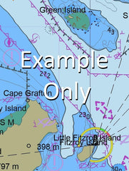
This AusENC packs contains all the Category 3, 4, 5 and 6 cells which overlap the area depicted in the map. The mapped area is based on the outer coverage of the category 5 and 6 cells within this pack. The category 3 and 4 cells not shown so as to avoid clutter. This pack does not include any category 1 or 2 cells.
For extensive detail on the symbology of nautical charts, the Admiralty Guide to ENC Symbols used in ECDIS is the definitive reference.
ENC Subscriptions
All AusENC packs are supplied as a subscription. This subscription gives you access to the updated information supplied by the Hydrographic Office throughout your subscription period.
Once your subscription is established, the Hydrographic Office will email you your permits (a small text file to load into your system), and then each fortnight will email you to advise if new permits need to be installed. This fortnightly email will also contain a link to the latest updates available.
Nearing the end of your subscription, we will contact you directly to confirm your requirements for a further renewal. You may also receive similar alerts from the Hydrographic Office.
AU130120 AU220120 AU415128 AU416128 AU5032P1 AU130120 AU130120 AU130120 AU130120 AU130120 AU130120 AU220120 AU130120 AU220120 AU415128 AU416128 AU5032P1 AU130120 AU220120 AU130120 AU130120 AU415128 AU416128 AU5032P1
3 Mile Valley Adolphus Island Agnew Point Alligator Rock Anthon Landing Australind Bank Barnes Island Beck Rocks Bessie Wiley Memorial Reserve Black Cliff Point Bluff Head Cambridge Gulf Camel Rock Canal Creek Cape Dussejour Cherrie Cove Cawston Bay Cedar Hill Channel Rock Chimooli Dam Coghlan Hill Coghlans Landing Cowan Patches Dilyan Spring Dome Hill Drayson Peak Dundas Point East Arm East Banks East Bastion East Patch Eddy Point Emu Hill Fairfax Island Fall Hill Five Rivers Lookout Flat Top Hill Forrest River Gap Hill Guthrie Banks Hardman Point Hare Channel Hay Point Helby Island Helby River Hog Back Hill Hunch Hill Ina Island Islet Point Kent Island Laffan Point Landslip Point Leading Hills Lena Hill Limpet Hill Lory Rock Lyne Point Lyne River Main Channel Malcolm Creek Mangrove Bay Mangrove Point Mermaid Point Mound Hill Mount Albany Mount Archdeacon Mount Connection Mount Jane Mount Tooker Mount Wilshere Mullet Point Myrmidon Bank Myrmidon Ledge Nellie Bay Nicholls Point Ord River Otway Island Panton Island Parry Creek Patch Point Pender Point Pile Point Prince Island Quoin Hill Red Head Red Hill Rees Point Roe Bank Russell Island Saville Island Scott Point Sellers Creek Sharp Peak South Patch Sphinx Rock Steep Head Stevens Channel Still Bay Stony Point The Gorge The Knoll Thompson River Vancouver Point Vans Rock View Hill View Hill Range Webster Bluff Wedge Hills West Arm West Bastion Fathom Rock Myrmidon Rock Coast Hill Ina Islet Pentecost River Nipple Spit Point Andrews Hill The Bastion Range Bastion Range