
AUS 802
Cape Liptrap To Kent Group
Please note that all charts are nominally folded in half for storage and handling as per the marine industries standard.
If you require an unfolded copy (ie: flat for framing), please select Flat Paper, and we will organise a special print service to accomodate your request.
Description
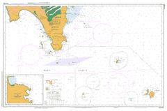
This official Nautical Chart is produced by the Australian Hydrographic Office, and corrected fortnightly to 'Notice to Marines' by Cairns Charts & Maps. This ensures it remains compliance with Safety of Navigation requirements. This marine chart, or 'sea map', is primarily produced to support the safe navigation of commercial shipping through Australian, Papua New Guinea and Solomon Island waters.
Nautical charts depict the seabed, or bathymetry, using a variety of colours to shade the depth regions. Darker blues indicate shallower water, while light blues and white indicate deeper water. A chart will also show continuous contour lines (at varying intervals depending on the scale of the chart), 'spot depths' across the whole area, as well as different symbols indicating wrecks, shallow rocks and dangers, as well as details on lights, light houses, tides and currents.
For extensive detail on the symbology of nautical charts, the Symbols and Abbreviations used on Admiralty Charts is the definitive reference.
Sandy Point Waratah Bay Anvil Rock Dover Island East Bluff East Cove East Islet East Moncoeur Island Beagle Point Big Rock Boundary Islet Clarendon Rock Cone Islet Crocodile Rock Curtis Group Curtis Island Curtis Island Nature Reserve Cutter Rock Deal Island Deal Island Conservation Area Devils Tower Devils Tower Nature Reserve Erith Island Flag Hill Fore Ness Francis Point Forty Foot Rocks Garden Cove Garden Point Hat Rock Hogan Group Hogan Island Hoskyn Peak Judgment Rocks Kent Group Kent Group National Park Long Islet Mount Keary Mount Mullett Murray Pass Myrmidon Bay Nautilus Bay Norfolk Point North East Isle North East Islet Nature Reserve North Rock Passage Rock Phillpot Peak Pulpit Rock Rodondo Island Rodondo Island Nature Reserve Round Islet South Bluff South West Isle Squally Cove Sugarloaf Rock The Funnel The Swashway Twin Islets Wallabi Cove West Bluff West Cove West Moncoeur Island West Moncoeur Island Nature Res ... Winter Cove Deal Island Lighthouse Mother-in-laws Leap Anderson Islets Anser Group Anser Island The Arched Rock Banksia Creek Banyalla Peak Bare Back Cove Barrys Creek Barrys Hill Bass Strait Bear Creek Beek Beek Point Bell Bennison Channel Bennison Island Big Hummock Bird Rock Mount Bishop Black Fish Creek Black Rock Boat Harbour Hill Bolger Anchorage Boulder Range Boulder Saddle Brown Head Buckleys Rock Bull Flat Bull Pass Cape Liptrap Cape Wellington Carpentaria Rock Cascade Creek Chinaman Beach Chinamans Creek Chinamans Knob Chinamans Long Beach Chinaman Swamp Citadel Island Skull Rock Cliffy Island Cooks Creek Corner Island Cotters Beach Cotters Lake Cove Creek Cow Creek Dannevig Island Darby Bay Darby Beach Darby River Darby Saddle Darby Swamp Deer Flats Diggers Island Drift Walking Track Duck Point Enclave Point Fairy Cove Falls Swamp Fenwick Bight Ferny Glade Ferr Creek First Bridge Creek Fishermans Creek Five Mile Beach Five Mile Camp Five Mile Peak Frasers Creek Freshwater Creek Freshwater Lake Glennie Group Granite Island Great Glennie Island Grinder Point Growlers Creek Hobbs Creek Hobbs Head Home Cove Horn Point Hunter Point Johnny Souey Cove Johnny Souey Point Johnny Souey Track Kanowna Island Kersop Peak Kulk La Trobe Range Lance Moon Park Larkin Cove Leonard Bay Leonard Point Lighthouse Point Lilly Pilly Gully Nature Walk Lillypilly Lillypilly Gully Little Oberon Little Oberon Bay Little Sugarloaf Little Waterloo Bay Long Island Lookout Rock Lookout Rocks Lower Barry Creek Camping Area McPhersons Creek Maitland Beach Martins Hill McHugh Island Middle Channel Middle Creek Millers Landing Miranda Bay Miranda Creek Monkey Creek Monkey Point Morgans Beach Morgans Creek Mount Boulder Mount Hunter Mount Latrobe Mount Leonard Mount Liptrap Mount Margaret Mount McAlister Mount Norgate Mount Oberon Mount Ramsey Round Backed Hill Mount Vereker Mount Wilson Night Out Norman Bay Norman Beach Norman Island Norman Point North Waterloo Bay Northey Hill Notch Island Oberon Bay Oberon Bay Walking Track Oberon Point Picnic Bay Picnic Creek Picnic Point Pillar Point Pony Creek Rabbit Island Rabbit Rock Rag Island Ramsbotham Rocks Red Bluff Beach Red Sand Hill Red Swamp Refuge Cove Refuge Cove Walking Track Roaring Meg Creek Rock Hill Sand Island Sandy Point Fire Station Sea Eagle Bay Seal Island Seal Islands Seal Rock Sealers Cove Sealers Cove Walking Track Sealers Creek Sealers Swamp Second Creek Seven House Hill Shallow Bight Shallow Inlet Shellback Island Silver Swamp Smith Cove South East Point South Peak South Point South Point Creek South West Point Sparkes Lookout Squeaky Beach Starvation Flat Stockyard Hill Sugar Basin Swamp Sugarloaf Tallang Telegraph Hill Telegraph Saddle Telegraph Swamp Watercress Creek The Bluff The Cathedral Three Mile Beach Three Mile Point Tidal River Tin Mine Cove Tin Mine Hill Tin Mine Point Titania Creek Tongue Point Townsend Point Townsends Point Vereker Range Vererer Outlook Walkerville Walkerville Primary School Waratah Waratah Bay Fire Station Warreen Waterloo Bay Waterloo Bay Walking Track Waterloo Point Wattle Island Whale Rock Whisky Bay Whisky Creek Whites Creek White Rock White Swamp Wilson Range Wilsons Promontory Wilsons Promontory National Park Windy Saddle Yanakie Yanakie Beach Yanakie Fire Station Yanakie Isthmus Yanakie Public Hall Yanakie South Chinamans Beach Ten Mile Creek Liptrap Arch Rock McPherson Creek Benison Island Wilson Promontory Direction Islands Rag Islet Darby Saint Leonard Mount Cleft Island Cleft Islet East Island West Moncoeur Island Nature Reserve Devil Tower North East Island Cone Island Judgement Rocks Sugar Loaf Sugarloaf Island South West Island