
GA SE51-02
Pender
Digital Products: You will receive an email shortly after checkout containing links to download your products.
If you do not receive this email within 30min, please check your Junk / SPAM email folder, prior to contacting us.
Description
This Topographic Map is produced by Geoscience Australia; Australia's national geospatial organisation.
GA topographic maps (many of which are produced in partnership with the Army) are generally older than those maps produced by the State Governments over the same area. This makes GA maps particularly useful for identifying historic features, such as old mines and diggings.
Geoscience Australia maps generally considered to be more pleasing in design and compilation then the more modern State Government productions.
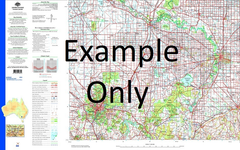
At this scale, 1cm on this map represents 2.5km on the ground (4cm = 10km). A standard map will cover 150km from east to west and 110km from north to south, with a contour interval of 50m. This map contains natural and constructed features including road and rail infrastructure, vegetation, hydrography, contours, localities and some administrative boundaries.
Please note the date of the map, as this will impact the currency of information, particularly regarding infrastructure, roads, etc.
Beagle Bay Lombadina Alarm Shoal Alligator Creek Anna Plain Well Anzac Shoal Awong Patch Baleine Bank Balk Bore Ball Rock Bargajoc Well Beagle Bay Aboriginal Reserve Beagle Bay Community Beagle Bay Mission Bell Point Bells Point Community Billard Community Black Rod Rock Bobby Creek Bobieding Community Boolaman Well Boolgin Bronglo Well Bulgin Community Buniol Community Burrguk Community Bygnunn Community Camp Inlet Cape Borda Cape Leveque Cape Leveque Aerodrome Cape Leveque Lighthouse Catamaran Bay Chile Creek Chile Creek Community Chile Head Chimney Rocks Chunelarr Creek Cliff Point Cocky Well Cygnet Bay Dampier Peninsula Danger Rocks Djaradjung Community Djarindjin Community Djoodood Community Djugarargyn Community Dominic Spring East Island East Island Lighthouse East Sandy Point Eclipse Shoals Elephant Point Embalgun Embalgun Community Emeriau Point Etheridge Patch First Yarp Gallen Well Gilbut Creek Gnamagun Well Gnylmarung Community Goobiny Community Goolarrgon Community Gregory Well Gudam Bunji Community Gulumonon Community Gurrbalgun Community Henry Well Hunter Creek Jambullana Well Jonas Shoal Joseph Well Julgnunn Community Kelk Creek Kooljamin Community Lacepede Channel Lacepede Islands Lacepede Islands Nature Reserve Ledge Point Leveque Island Lomat Well Lombadina Community Lombadina Creek Lombadina Mission Lombadina Point Lombardachin Bore Lord Mayor Shoal Loumard Community Lumad Well Main Yarp Mangrove Point Martins Well Mcvilly Rock Middle Island Middle Lagoon Community Milligan Creek Mudnunn Community Murphy Creek Community Neem Community Ngadalargin Community Ngamakoon Community Nillygan Community North Head Nyilil Community Nyul Nyul Community Nyumwah Community Packer Island Pender Pender Bay Perpendicular Head Pitt Shoals Robber Rocks Rumbul Bay Sandy Island Sandy Point Second Yarp Shag Rocks Shepherds Patch Sloper Shoal South Head Steel Star Surprise Reef Tappers Inlet Tappers Inlet Community Thomas Bay Thomas Well Tooker Point Top Balk Bore Walker Rock Weedong Lagoon Weedong Well West Island Weston Patch Woodhouse Rocks Wulgurding Community Yallet Community Yallet Creek Ferret Reef Leveque Islet Gnamagum Well Lombardina Mission Awong Rock Lombardina Gulf Lombardina Creek Cullen Well MacDonald Rock Lombardina Point Lomal Well Stone Hill Melligo Creek McVilly Rock Jumbullanna Well Western Patch Lombardatchem Well Lombardatchen Well Emeriau Head Middle Islet Sandy Islet Eclipse Shoal Lamarc Well East Islet Hickey Bornhardt Well Matthias Well Eugene Spring Domining Spring Wompangold Spring Baldwin Well Josephs Well Bungadoc