
NSW 8927-2N
Milton
Digital Products: You will receive an email shortly after checkout containing links to download your products.
If you do not receive this email within 30min, please check your Junk / SPAM email folder, prior to contacting us.
Description
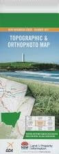
This Topographic Map is produced by the New South Wales Government.
This map is supplied in digital in PDF format, which means it can be printed at home or sent to a professional printer for a 100% scale reproduction.
At this scale, 4cm on this map represents 1km on the ground. A standard map (which is square) covers an area of approximately about 12.5km by 12.5km, with a contour interval of 10m. This map contains natural and constructed features including road and rail infrastructure, vegetation, hydrography, contours, localities and some administrative boundaries.
Kings Point Lake Conjola Lake Conjola West Milton Ulladulla Armours Creek Bannisters Point Berry Head Buckleys Beach Buckleys Point Yatteyattah Cambage Head Conjola Island Croobyar Croobyar Creek Croobyar State Forest Currowar Creek Davison Head Falls Creek Florance Head Hume Head Ingold Gap Jindelara Creek Green Island Mount Kingiman Kingiman Range Kingiman Ridge Lake Conjola Post Office Landslide Landslide Creek Leaning Oak Point Lightning Creek Little Forest Little Forest Creek Longfella Pass Millards Creek Milton Post Office Milton Public School Milton Reservoir Mollymook Mollymook Beach Mollymook Creek Mollumook Post Office Yatteyattah Nature Reserve Narrawallee Narrawallee Creek Narrawallee Creek Nature Reserve Narrawallee Inlet Ngadyoo Falls Oyster Point Pallin Pass Pattimores Lagoon Picnic Bay Pidgeon House Canyon Pigeon House Pigeon House Creek Pigeon House Gorge Pointer Gap Pointer Gap Lookout Pointer Mount Pointer Mountain Porters Creek Preservation Rock Princess Island Racecourse Beach Racecourse Creek Roberts Point Rotary Lookout Rusden Head Sandridge Cemetery Sandy Point South Creek Station Point Stony Creek Talaterang Creek Talaterang Mountain Talaterang Mount Ulladulla Harbour Ulladulla Head Ulladulla High School Ulladulla Post Office Ulladulla Lighthouse Ulladulla Public School Ulladulla Wildflower Reserve Warden Head Wombat Ridge Woodstock Creek Yackungarrah Creek Yatteyatah Post Office Yooralla Bay Yooralla Lake Dithol Creek Doctors Creek Dummal Creek Burrill Lake South Pacific Heathland Reserve Yatteyatah Milton Memorial Park Collers Beach Edith Twynam Reserve Mollymoke Farm Creek Blackwater Creek Leaneys Creek Pettys Creek Martins Gap Egans Gap Narrawallee Beach Arthur Jones Reserve Budawang School For Specific Purposes Lake Conjola Pioneers Reserve Ulladulla Rotary Park Pattemore Lagoon Conjola Park Woodburn Woodstock Yatte Yattah Rennies Beach Didthul Ulladulla Sports Park Garrad Reserve Claydons Creek Mount Sydney Mount Sidney Cooks Pigeon House