
NSW 8930-4S
Hampton
Digital Products: You will receive an email shortly after checkout containing links to download your products.
If you do not receive this email within 30min, please check your Junk / SPAM email folder, prior to contacting us.
Description
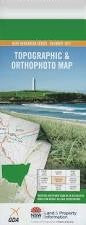
This Topographic Map is produced by the New South Wales Government.
This map is supplied in digital in PDF format, which means it can be printed at home or sent to a professional printer for a 100% scale reproduction.
At this scale, 4cm on this map represents 1km on the ground. A standard map (which is square) covers an area of approximately about 12.5km by 12.5km, with a contour interval of 10m. This map contains natural and constructed features including road and rail infrastructure, vegetation, hydrography, contours, localities and some administrative boundaries.
Lejaro Bra Montana Sunshine Valley Lily Vale Tayburn Rosevale Redbank Runnymede Alkoomie Coombe Park Barwon Park Belmont Ormond Farm Upper Glen Bimbadoon Grandview Maroo Park Wingebelaley Fairview Glenlea Gummakunulla Redfern Chaplow Sugarloaf Farm Warekila Hampton Lodge Bindo Glen Shea Nicedale Te Whare Yapunyah Willow Vale Hillview Smithfield Euroka Willenber Farm Sunny Ridge All Flats Creek Alum Creek Billy Healey Billy Healey Hill Black Gin Creek Black Flat Gully Blackfellow Creek Blackfellow Hill Bindo Pinch Mount Bindo Bindo Creek Boggy Creek Bonfire Hill Chain of Mount Creek Chaplowe Creek Coxs River Cullenbenbong Creek Euroka Ridge Fern Creek Ganbenang Ganbenang Creek Gibraltar Creek Gibraltar Rocks Gibraltar Sugarloaf Gum Valley Creek Gulf Creek Hampton Hampton Creek Hampton Park Hampton Public School Hampton State Forest Hargreaves Harrys Creek Hawks Gully Honeysuckle Gully Jenolan State Forest Jimmys Gully Kanimbla Kanimbla Creek Kanimbla Valley Chain of Ponds Chainy Mount Creek Cullenbenbong Swamp Ganbenang Valley Hawkes Creek Jemmys Creek Kurranburrock Reserve Lipeys Creek Long Swamp Creek Marsdens Rock Marsdens Swamp Megalong Valley Mini Mini Range Mini Mini Saddle Murdering Creek Nortons Creek Off Flats Creek Old Ford Reserve Paddys Creek Panorama Point Pinnacle Hill Pinnacle Ridge Ryans Creek Sailor Creek Sandy Hook Mount Sandy Schoolhouse Creek Sour Flat Creek Southern Branch of Upper River Stony Creek Sugarloaf Peak The Sugarloaf Table Hill Table Mountain Table Rock Tinkers Hill Triangle Creek Upper Run Creek Walkers Gully Waterfall Creek Wicketty War Creek Willow Reserve Dry Gully Donnellys Swamp Dry Creek Barnier Public School Somerset Reserve Katies Creek Megalong