
QLD 9541-34
QLD 9541-34
Digital Products: You will receive an email shortly after checkout containing links to download your products.
If you do not receive this email within 30min, please check your Junk / SPAM email folder, prior to contacting us.
Description
This Topographic Map is produced by the Department of Natural Resources and Mines (DNRM), part of the Queensland Government.
This product is continously updated with the latest information available. New editions are generally published in Oct/Nov each year, however minor updates are constantly being included.
DNRM maps are produced automatically by computers, with minimal human oversight; so some duplication of information and occasional minor cartographic inconsistencies can be found.
The PDF version of this can be printed at home or sent to a professional printer for a 100% scale reproduction.
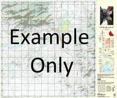
At this scale, 4cm on this map represents 1km on the ground. A standard map (which is square) covers an area of approximately about 12.5km by 12.5km, with a contour interval of 10m. This map contains natural and constructed features including road and rail infrastructure, vegetation, hydrography, contours, localities and some administrative boundaries.
Cedar Glen Border Ranges National Park Mount Hutley Hutley Range Isakeson Ridge Macdonald Ridge Mcpherson Range Mann Spur Point Lookout Tweed Valley Lookout Mount Nungulba Buchanans Fort Christmas Creek North Branch Christmas Creek South Branch England Creek Ferntree Gap Creek Lamington Falls Lamington Glen Lamington Plateau Larapinta Falls Little Widgee Mountain McPherson Range Neglected Mountain Nungulba Mount Razorback Running Creek North Branch Running Creek South Branch Waterfall Creek Mount Westray Mount Widgee Lamington Mount Gipps Bujera