
NSW 7135
Corona
Digital Products: You will receive an email shortly after checkout containing links to download your products.
If you do not receive this email within 30min, please check your Junk / SPAM email folder, prior to contacting us.
Description
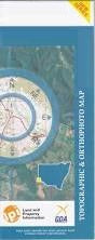
This Topographic Map is produced by the New South Wales Government.
This map is supplied in digital in PDF format, which means it can be printed at home or sent to a professional printer for a 100% scale reproduction.
At this scale, 1cm on this map represents 1km on the ground. A standard map (which is square) covers an area of approximately 54km by 54km, with a contour interval of 20m. This map contains natural and constructed features including road and rail infrastructure, vegetation, hydrography, contours, localities and some administrative boundaries.
Lynray Floods Creek Mc Dougalls Well Mount Woowoolahra Yandaroo Gum Park Corona Kantappa Mulga Valley Wilangee Poolamacca Alberta Creek Campbells Creek Bore Corona Springs Floods Range Corona Creek Lewis Peak Lewis Point Morphetts Creek North Barrier Soapstone Creek Tarltala Creek Tarrawingee Tarrawingee Springs Willowurrawa Creek Woowoolahra Alberta Badjerrigarn Campbell Chamberlain Cook Glenmore Harris Mulcatcha Sturt Yowahro Patterson Torrowangee Boco Linray McDougalls Well Mount Woowoolahrah Kulka Main Barrier Range Barrier Range Barrier Ranges Broken Hill Upland Broken Hill Uplands Main Dividing Range Stanley Range Willangee