
NSW 7136
Teilta
Digital Products: You will receive an email shortly after checkout containing links to download your products.
If you do not receive this email within 30min, please check your Junk / SPAM email folder, prior to contacting us.
Description
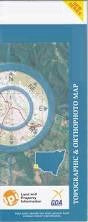
This Topographic Map is produced by the New South Wales Government.
This map is supplied in digital in PDF format, which means it can be printed at home or sent to a professional printer for a 100% scale reproduction.
At this scale, 1cm on this map represents 1km on the ground. A standard map (which is square) covers an area of approximately 54km by 54km, with a contour interval of 20m. This map contains natural and constructed features including road and rail infrastructure, vegetation, hydrography, contours, localities and some administrative boundaries.
Sanpah Pine Ridge Pine View Westwood Downs Broughams Gate House Joulnie Avenel Teilta Mount Westwood Barrier Range Part Of Eight Mile Swamp Five Mile Swamp Honeymoon Creek Joans Swamp The Five Mile Mcclures Lake Marksers Swamp North Swamp Paradise Creek Paradise Lake Round Swamp Swan Lake Teilta Creek Teilta Lake Twelve Mile Waterhole Yellow Waterhole The Yellow Water Hole Bull Hill Dry Lake Brunker Burgess Cultee Gould Stanley Wammerra Wonna Border Brougham Gate Packsaddle Creek Floods Creek Teilta Out Station