
NSW 7139
Fort Grey
Digital Products: You will receive an email shortly after checkout containing links to download your products.
If you do not receive this email within 30min, please check your Junk / SPAM email folder, prior to contacting us.
Description
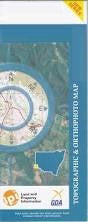
This Topographic Map is produced by the New South Wales Government.
This map is supplied in digital in PDF format, which means it can be printed at home or sent to a professional printer for a 100% scale reproduction.
At this scale, 1cm on this map represents 1km on the ground. A standard map (which is square) covers an area of approximately 54km by 54km, with a contour interval of 20m. This map contains natural and constructed features including road and rail infrastructure, vegetation, hydrography, contours, localities and some administrative boundaries.
Fortville House Fort Grey White Catch Cottage Whitecatch House Waka Lake Stewart Hewart Downs Bancannia Waterhole Breakfast Time Swamp Fort Grey Basin Frome Swamp Frome Waterhole Kellys Lake Mudross Swamp Old Woolshed Swamp Pinaroo Lake Stony Rise Strzelecki Desert The Big Plain Tiramina Lake Tuneeilkeree Swamp Wild Duck Swamp St George Lake Nantomoko Pinaroo Stewart Tindara Yarraba Yarriarraburra Swamp Carruthers Sallys Tank Fromes Creek Collins Bore White Catch House Yebna Bore Butlers Tank Munkartie House