
NSW 7232
Middle Camp
Digital Products: You will receive an email shortly after checkout containing links to download your products.
If you do not receive this email within 30min, please check your Junk / SPAM email folder, prior to contacting us.
Description
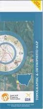
This Topographic Map is produced by the New South Wales Government.
This map is supplied in digital in PDF format, which means it can be printed at home or sent to a professional printer for a 100% scale reproduction.
At this scale, 1cm on this map represents 1km on the ground. A standard map (which is square) covers an area of approximately 54km by 54km, with a contour interval of 20m. This map contains natural and constructed features including road and rail infrastructure, vegetation, hydrography, contours, localities and some administrative boundaries.
Wendi Backwell Middle Camp Kudgee South Ita Double Yards Woolcunda Coombah Lake Coombah Gum Holes Kudgee Lake Lake Nettlegoe Mitta Nettlegoe Lake North Base Tarro Railway Station Waneba West Mitta Antita Milang Nadbuck Nalim Wallara Wanneba Wannella Ramleh Nettlegoe Number Nine Bore Blackwell Pine Creek Acacis Tank New Well Creek Bonds Bore Black Hut Tank Stanley Bore Quandong Tank Woolcundah Red Tank Coombah Roadhouse