
NSW 7235
Fowlers Gap
Digital Products: You will receive an email shortly after checkout containing links to download your products.
If you do not receive this email within 30min, please check your Junk / SPAM email folder, prior to contacting us.
Description
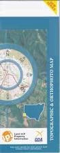
This Topographic Map is produced by the New South Wales Government.
This map is supplied in digital in PDF format, which means it can be printed at home or sent to a professional printer for a 100% scale reproduction.
At this scale, 1cm on this map represents 1km on the ground. A standard map (which is square) covers an area of approximately 54km by 54km, with a contour interval of 20m. This map contains natural and constructed features including road and rail infrastructure, vegetation, hydrography, contours, localities and some administrative boundaries.
Floods Creek Fowlers Gap Research Station Rowena Sturts Meadows Bijerkerno Acacia Downs Lintis Vale Acacia Barrier Ranges Bluff Caloola Bluff Caloola Creek Condah Creek Corona Dering Mount Dering Euriowie Euriowie Creek Euriowie Tank Fowlers Gap Fowlers Gap Tank Gap Gum Creek Homestead Creek Joes Waterhole Joes Hole Main Barrier Range Mount Pintapah or Euriowie One Tree Hill Picnic Creek Mount Pintapah Poison Creek Poolamacca Creek Quarry Nob Rocky Creek Slate Range Teamsters Creek Te Uro Creek The Bluff Wallace Creek Byjerkerno Creek Byjerkerno Range Byjerkerno Ridge Byjerkerno Waterhole Bligh Byjerkerno Tanyarto Bomgadah Donnelly Forrest Maropinna Teegarraara The Gap The Gap Out Station Camels Hump