
NSW 7239
Olive Downs
Digital Products: You will receive an email shortly after checkout containing links to download your products.
If you do not receive this email within 30min, please check your Junk / SPAM email folder, prior to contacting us.
Description
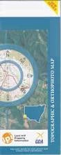
This Topographic Map is produced by the New South Wales Government.
This map is supplied in digital in PDF format, which means it can be printed at home or sent to a professional printer for a 100% scale reproduction.
At this scale, 1cm on this map represents 1km on the ground. A standard map (which is square) covers an area of approximately 54km by 54km, with a contour interval of 20m. This map contains natural and constructed features including road and rail infrastructure, vegetation, hydrography, contours, localities and some administrative boundaries.
Toona House Warri House Binerah Downs Olive Downs Binerah Well Mount King Stone Hut Gum Vale Andrews Creek Becks Waterhole Black Stump Dam Box Creek Churriga Waterhole Connia Creek Coxs Creek Cutting Creek Deadmans Creek Easter Monday Creek Eight Mile Creek Evans Gully Evelyn Creek Fromes Creek Ganya Creek Jeffreys Flat Mcdonald Peak Mcdonalds Peak Mokely Creek Mokely Tank Mokely Waterhole Mount King Bore North Warratta Creek Nuggetty Hills Nuggety Creek Nuggety Hill Pic Du Faur Pig Hole The Sisters Six Mile Hills Sturt National Park Tindara Tank Tindora Waterhole Warratta Creek Warri Warri Bore Warri Warri Village Burtons Creek Sturt Olive Warri Warri Warri Creek Warry Warry Gate McDonalds Peak McDonald Peak Mount King East Mount King East Station Mokely Gumvale