
NSW 8128-4N
Whitton
Digital Products: You will receive an email shortly after checkout containing links to download your products.
If you do not receive this email within 30min, please check your Junk / SPAM email folder, prior to contacting us.
Description
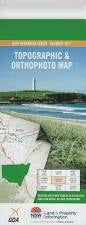
This Topographic Map is produced by the New South Wales Government.
This map is supplied in digital in PDF format, which means it can be printed at home or sent to a professional printer for a 100% scale reproduction.
At this scale, 4cm on this map represents 1km on the ground. A standard map (which is square) covers an area of approximately about 12.5km by 12.5km, with a contour interval of 10m. This map contains natural and constructed features including road and rail infrastructure, vegetation, hydrography, contours, localities and some administrative boundaries.
Whitton Boomerang Beach Colaragang Cuba Cuba State Forest Dallas Darlington Lagoon Darlington Point Post Office Darlington Point Public School Darlington Point Euwarderry Lagoon Gogeldrie Main Southern Drain Gooragool Lagoon Horseshoe Lagoon Hulong Lady Jane Beach Matangry Lagoon Mantangary Lagoon Murrumbidgee State Forest Narrancoolambund Lagoon Narrancoolambung Lagoon The Point Beach Point Beach Powerhouse Lagoon Reserve Beach Stanbridge Stanbridge Swamp Stick Lagoon Sturt Canal Ungundury Lagoon Waddi Creek Waradgery Beach Whitton Common Whitton Public School Whitton Punt Reserve Whitton Railway Station Willbrigee State Forest Willbriggie State Forest Yarramungueer Lagoon Diggers Beach Waddi Bareena Creek