
NSW 8326-2N
Narra Narra
Digital Products: You will receive an email shortly after checkout containing links to download your products.
If you do not receive this email within 30min, please check your Junk / SPAM email folder, prior to contacting us.
Description
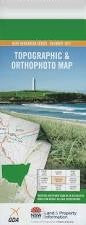
This Topographic Map is produced by the New South Wales Government.
This map is supplied in digital in PDF format, which means it can be printed at home or sent to a professional printer for a 100% scale reproduction.
At this scale, 4cm on this map represents 1km on the ground. A standard map (which is square) covers an area of approximately about 12.5km by 12.5km, with a contour interval of 10m. This map contains natural and constructed features including road and rail infrastructure, vegetation, hydrography, contours, localities and some administrative boundaries.
Woomargama Back Creek Basin Creek Chinamans Hat Devils Creek Eleven Mile Creek Fish Creek Germanton Green Reserve Creek Hacketts Hill Jergyle Mount Jergyle Kelly Creek Friday Mount Lowes Hill Mount Mckenzie Mount Mclaurin Mitchell Mountain Creek Mount Arran Mount Pleasant Narra Narra Narra Narra Wa or Mount Pleasant Norths Lookout Oaky Bulga Reddal Creek Reddall Creek Reddalls Valley Sandy Creek Scent Bottle Creek South Creek Spring Creek Ten Mile Creek Tin Mines Tunnel Creek Wilson Creek Woomargama State Forest Dora Dora Wantagong Annandayle South Narra Narra Wa