
NSW 7628-S
Perekerten
Digital Products: You will receive an email shortly after checkout containing links to download your products.
If you do not receive this email within 30min, please check your Junk / SPAM email folder, prior to contacting us.
Description
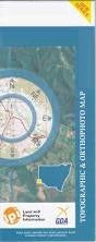
This Topographic Map is produced by the New South Wales Government.
This map is supplied in digital in PDF format, which means it can be printed at home or sent to a professional printer for a 100% scale reproduction.
At this scale, 2cm on this map represents 1km on the ground. A standard map (which is square) covers an area of approximately about 25km by 25km, with a contour interval of 10m. This map contains natural and constructed features including road and rail infrastructure, vegetation, hydrography, contours, localities and some administrative boundaries.
Big Sandhill Lake Binbinette Binbinette Railway Station Box Creek Box Lagoon Catch A Monkey Lake Chinamans Clump Condoulpe Condoulpe Lake Dusty Lake Five Tree Dam Harveys Lake Kerkeri Kerkeri Lake Impimi Railway Station Kerkery Lake Kyalite Kyalite State Forest Lake Leriwa Liewa Liewa State Forest Lintot Lintot Lake Little Sandhill Lake Lyle Lake Mein Merwin Lake Merwin Moolpa Moopla Railway Station Murwin Village of Perekerten Perekerten Perekerten Railway Station Perekerten Station Salisbury Sugar Basin Lake Lake Talbetts Lake Tearre Ten Mile Creek Ten Mile Tank Turora Twelve Mile Creek Upper Sandhill Lake Winter Yanga Tank Burrawang Wombah Impimi The Willows Keri Keri Myall Farm Spring Plain Keri-Keri Merwein Kingle Yal Yal Lake Lyle Liewah Bibinette