
NSW 7729-N
Oxley
Digital Products: You will receive an email shortly after checkout containing links to download your products.
If you do not receive this email within 30min, please check your Junk / SPAM email folder, prior to contacting us.
Description
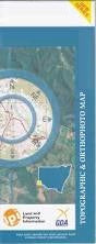
This Topographic Map is produced by the New South Wales Government.
This map is supplied in digital in PDF format, which means it can be printed at home or sent to a professional printer for a 100% scale reproduction.
At this scale, 2cm on this map represents 1km on the ground. A standard map (which is square) covers an area of approximately about 25km by 25km, with a contour interval of 10m. This map contains natural and constructed features including road and rail infrastructure, vegetation, hydrography, contours, localities and some administrative boundaries.
Nandum Keiross Glen Alvie Merienium Duckshot Aubrey Dale Noonamah Oxley Oxley Downs Tupra The Brass Butt Willow Dale Corrong Norwood Thelangerin Geramy Baconian Swamp Buckonyong Creek Lake Comayjong Cumbungy Creek Corrong Station Lignam Lake Lignum Lake Mcfarlands State Forest Merrimajeel Creek Merrinageal Creek Moologa Lake Muloga Lake Murrumbidgell or Merrimajeel Creek Nandum Tank Town of Oxley Oxley Cemetery Oxley State Forest Ryans Lake Thellangering West Yimbaring Dowling The Dry Lake Lake Bungarry Tooralboung Flora Reserve Boocathan Toorong Sahara East Brassbutt Buckonyong Bungarry Matamong Mulloga Pimpara Toopruck Tooralboung Lagan Wyunga