
NSW 9140-S
Texas
Digital Products: You will receive an email shortly after checkout containing links to download your products.
If you do not receive this email within 30min, please check your Junk / SPAM email folder, prior to contacting us.
Description
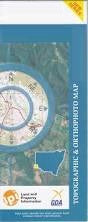
This Topographic Map is produced by the New South Wales Government.
This map is supplied in digital in PDF format, which means it can be printed at home or sent to a professional printer for a 100% scale reproduction.
At this scale, 2cm on this map represents 1km on the ground. A standard map (which is square) covers an area of approximately about 25km by 25km, with a contour interval of 10m. This map contains natural and constructed features including road and rail infrastructure, vegetation, hydrography, contours, localities and some administrative boundaries.
Lochiel Riverview Pioneer Farm Pipersleigh Avondale Orana Koolgunyah Cluden Oakleigh Lyndale Runnymede Oakpark Wilga Park Milnedah Tooliambi Lisavale Bundanoon Redgate Callemondah Tarwoona Ramley Arcot Pine Vale Rainbow Willow Wood Clearview Gibralta Stomer Glenlyon Ardenlea Mascotte Woodbine Glengunyah Rosedale Black Springs Romani Brockhampton Barelli Riverbend Mia Mia Corner View Silver Spur Twin Hills Linton Boondah Rosehill Calm Downs Cloverdale Dorrington Gunyan Raleigh Benwerrin Wilgervale Russenden Larnock Clayton Craigie Eversley Kurraba Birrinbah Gum Camp Emu Plains Emu Park Texas Atholwood Big Hill Creek The Blacks Rock Bonshaw Bonshaw Weir Boxwell Island Camp Creek Ellis Goonian Green Hill Creek Gum Camp Gully Hetherington Horse Creek Horse Gully East The Island Lickinghole Creek Lickinghole Creek East Meriti Oaky Creek Oaky Creek West Rush Gully Sally Gully Sally or Sharps Creek Sandy Creek Sharps Creek Sharps Gully Smithfield Crossing Tindall Gully Waddy Mandoe Crossing Watts Gully Dinner Corner Creek Dumaresq River Twin Rivers Horse Gully Alpin Creek Apple Tree Creek Back Creek North Branch Bear Creek Blackfellow Creek Branch Creek Bull Creek Claremont Clay Waterhole Creek Clive Coxs Sugar Loaf Dingo Creek Dry Creek Fish Hole Mountain Lake Glenlyon Gum Island Mount Gunyan Little Plain Creek Little Plains Creek Middle Creek Mundoey Reedy Creek Rocky Creek Smithlea Spring Creek Stockyard Creek Tea Tree Creek Tea-Tree Creek Texas Mount The Red Gate Waddy Mundoey Creek Waddy Mundoey Crossing Warwick Hill Glenlyon Dam Smithfield Mundoey Station Browns Creek Coxs Sugarloaf Silverspur Pike Creek Reservoir