
QLD 6552
QLD 6552
Digital Products: You will receive an email shortly after checkout containing links to download your products.
If you do not receive this email within 30min, please check your Junk / SPAM email folder, prior to contacting us.
Description
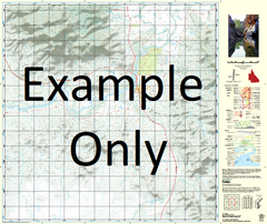
This Topographic Map is produced by the Department of Natural Resources and Mines (DNRM), part of the Queensland Government.
This product is continously updated with the latest information available. New editions are generally published in Oct/Nov each year, however minor updates are constantly being included.
DNRM maps are produced automatically by computers, with minimal human oversight; so some duplication of information and occasional minor cartographic inconsistencies can be found.
The PDF version of this can be printed at home or sent to a professional printer for a 100% scale reproduction.
At this scale, 1cm on this map represents 1km on the ground. A standard map (which is square) covers an area of approximately 54km by 54km, with a contour interval of 20m. This map contains natural and constructed features including road and rail infrastructure, vegetation, hydrography, contours, localities and some administrative boundaries.
Mithaka Waterhole Beattie Creek Boowonga Brumby Waterhole Bucket Creek Clayhole Creek Colvend Donerale Dynamite Creek Dynamite Waterhole Eleven Mile Corner Gidya Waterhole Gum Hole Kelly Creek Lignum Hole Lincluden Mallow Malvina Creek Mulligan Creek Neeyamba Hill Oodatra Point Poodyea Point Pulatera Hills Pump Waterhole Pybbagene Waterhole Qualunga Waterhole Rifle Waterhole Ripunthala Creek Rocky Waterhole Salt Hole Six Mile Waterhole Toko Toko Gorge Toko Waterhole Wariltha Waterhole Zuta Waterhole Boowangra Dam Linda Hill Minnaritchie Hill Number Ten Bore