
QLD 6751
QLD 6751
Digital Products: You will receive an email shortly after checkout containing links to download your products.
If you do not receive this email within 30min, please check your Junk / SPAM email folder, prior to contacting us.
Description
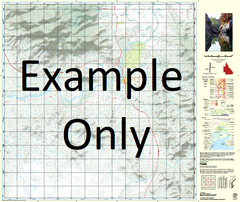
This Topographic Map is produced by the Department of Natural Resources and Mines (DNRM), part of the Queensland Government.
This product is continously updated with the latest information available. New editions are generally published in Oct/Nov each year, however minor updates are constantly being included.
DNRM maps are produced automatically by computers, with minimal human oversight; so some duplication of information and occasional minor cartographic inconsistencies can be found.
The PDF version of this can be printed at home or sent to a professional printer for a 100% scale reproduction.
At this scale, 1cm on this map represents 1km on the ground. A standard map (which is square) covers an area of approximately 54km by 54km, with a contour interval of 20m. This map contains natural and constructed features including road and rail infrastructure, vegetation, hydrography, contours, localities and some administrative boundaries.
Amaroo Anderson Hole Creek Bengeacca Birumby Creek Brecknock Brumby Waterholes Camp Flat Creek Charles Hole Creek Charles Waterhole Mount Coley Cottonbush Creek Dingo Yard Eight Mile Yard Gap Creek Gridyea Creek Herbert Downs Herbert Downs Water Facility Ina La Touche Creek Latouche Mount Latouche Minniritchie Creek Mount Coley Creek Mylrea Old Coochybung Yard Paravituari Paravituari Waterhole Pembroke Picton Ration Creek Rocky Creek Rocky Yard Sugarloaf Hill Tank Waterhole Tobin Mount Tobin Whitewood Yard Amaroo Boulia Shire La Touche River La-Touche Creek Mount Coley Tank Whitewood Tanks Coochiebung Tank Hilary Dam