
QLD 6756
QLD 6756
Digital Products: You will receive an email shortly after checkout containing links to download your products.
If you do not receive this email within 30min, please check your Junk / SPAM email folder, prior to contacting us.
Description
This Topographic Map is produced by the Department of Natural Resources and Mines (DNRM), part of the Queensland Government.
This product is continously updated with the latest information available. New editions are generally published in Oct/Nov each year, however minor updates are constantly being included.
DNRM maps are produced automatically by computers, with minimal human oversight; so some duplication of information and occasional minor cartographic inconsistencies can be found.
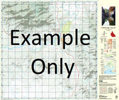
The PDF version of this can be printed at home or sent to a professional printer for a 100% scale reproduction.
At this scale, 1cm on this map represents 1km on the ground. A standard map (which is square) covers an area of approximately 54km by 54km, with a contour interval of 20m. This map contains natural and constructed features including road and rail infrastructure, vegetation, hydrography, contours, localities and some administrative boundaries.
New May Downs Mount Isa Beetle Creek Big Sandy Creek Breakaway Creek Bright Hebden Holmfirth Kennedy Creek King Gully Kitty Plain Lagoon Creek Lena Creek Little Sandy Creek Little Templeton River Little Toby Creek Meltham Mica Creek Miles Gully Norden Oldman Crossing Prestwich Rishworth Rochedale Rotary Hill Royton Slaughteryard Creek Sowerby Spear North Branch Creek Spring Creek Star Gully Sybella Creek Happy Valley Kalkadoon Lanskey Menzies Miles End Mornington Mount Isa City Parkside Ryan Soldiers Hill Spreadborough The Gap Mount Isa City Winston Spring Creek Well Hilton Substation Mungoona Waterhole Town Bore Mary Kathleen Tailings Dam Gap Bore Templeton Bore Junction Bore Big Toby Creek Carters Bore Blacks Bore Toby Creek Bore Dingo Hole Bore