
QLD 6760
QLD 6760
Digital Products: You will receive an email shortly after checkout containing links to download your products.
If you do not receive this email within 30min, please check your Junk / SPAM email folder, prior to contacting us.
Description
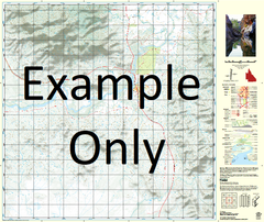
This Topographic Map is produced by the Department of Natural Resources and Mines (DNRM), part of the Queensland Government.
This product is continously updated with the latest information available. New editions are generally published in Oct/Nov each year, however minor updates are constantly being included.
DNRM maps are produced automatically by computers, with minimal human oversight; so some duplication of information and occasional minor cartographic inconsistencies can be found.
The PDF version of this can be printed at home or sent to a professional printer for a 100% scale reproduction.
At this scale, 1cm on this map represents 1km on the ground. A standard map (which is square) covers an area of approximately 54km by 54km, with a contour interval of 20m. This map contains natural and constructed features including road and rail infrastructure, vegetation, hydrography, contours, localities and some administrative boundaries.
Fiery Downs Arawan Augustus Baines Bullock Creek Emu Creek Flood Gorge Waterhole Gregory Downs Horse Creek Limestone Creek Little Cartridge Creek Little Horse Creek Mellish Park Mount Merlin Old Planet Downs Pear Tree Planet Downs Plumtree Creek Sandyhole Water Facility Sixteen Mile Waterhole Tafilet Tagassa Temmum The Knob Tintaldra Twelve Mile Hut Twelve Mile Waterhole Two Mile Creek Walwa Willis Lookout Yeldham Gregory Four Mile Creek Gregory Down Eight Mile Waterhole Kamarga The Nobbies