
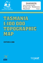
TAS 8213
Shannon
Digital Products: You will be forwarded a copy of your digital product via email the following business day.There are no automatic download services available for Tasmap digitial products.
Digital Limitations: Please note that the digital version of these maps DO NOT contain borders, legends, scales, etc. Where a product covers multiple areas, each area is provided as a seperate file. These may not be suitable for use as a print product.
Description
This Topographic Map is produced by the Department of Primary Industries, part of the Tasmanian Government.
These maps are an important resource for Government, industry, and the public. They are used for environmental and emergency management, farm planning and mineral exploration. They are also popular for recreational users such as bushwalkers, mountain bike and horse riders.
The PDF version of this can be printed at home or sent to a professional printer for a 100% scale reproduction.
At this scale, 1cm on this map represents 1km on the ground. A standard map (which is square) covers an area of approximately 54km by 54km, with a contour interval of 20m. This map contains natural and constructed features including road and rail infrastructure, vegetation, hydrography, contours, localities and some administrative boundaries.
Pensford Wihareja Roscarborough St Patricks Plains Ponderosa Kluan Christian Marsh Bashan Hunterston Walruna Bromley Jean Banks Shannon Rockford Glengowan Hermitage Southernfield Glenmark Dungrove Sunny Banks Cloverdale Range The Cluny East Cluny Forest Green Selma Wellwood Hartfield Ratho Shawfield Ousedale Ashton Clairveaux Cooma Stockwell Meadsfield Cleveland Glen Dhu Nalya Berriedale Humbie Pear Tree Green Hills Kenmere Wenlock Rotherwood Carinyah Blackwood Guilford Lientwardine Cawood Sherwood Lachlan Vale Katrine Vale Montacute Llanberis Tasmania Ouse Wilburville Abyssinia Creek Allwrights Lagoons Andrews Bridge Doves Creek Dripstone Hill Dry Hills Dry Hills Creek Drying Ground Ridge Duck Island Duck Marsh Duck Rivulet Duckhide Bay Duckhole Lagoons Duckholes Lagoons Nature Reserve Dungrove Hill Dunns Hill Earleys Marsh Earthquake Gully East Bay Echo Dam Echo Forebay Arthurs Dam Ashton Creek Ashton Sugarloaf Axford Creek Backwater Shore Bakers Tier Bark Hut Creek Bark Hut Plains Barn Shore Barrack Hill Barren Plains Barren Tier Bashan Ledge Bashan Plains Bashan Plains Rivulet Batchelors Flat Batchlers Shore Bawleys Peak Bedding Hill Beginners Bay Bellevue Tier Bells Bare Hill Benneworth Corner Bens Bottom Bens Marsh Beuton Hill Beuton Marsh Big Burns Lagoon Big Snake Hill Bilton Hill Black Bobs Black Bobs Rivulet Black Bobs Spur Black Hill Black Hill Creek Black Johnnys Tier Blackboys Opening Blackburn Creek Blair Hill Blue Hill Bluegum Bank Boggy Marsh Rivulet Bonapartes Creek Bothwell Bothwell Golf Course Bradys Lake Bradys Sugarloaf Breakfast Bay Briary Gully Brocks Bay Broken Bay Broken Bay Creek Broken Bridge Creek Broken Pole Gully Broncos Hill Bronte Bay Brown Marsh Brown Marsh Tier Brownie Bay Buffers Lookout Bull Bank Bullock Marsh Bung Bung Creek Burburys Shore Burdetts Bay Burstgall Hill Bushmans Hill Bushrangers Gully Butchers Bottom Butlers Flat Calton Hill Canal Bay Canal Shore Carrot Hill Catagunya Dam Cathedral Bay Cawood Hill Cawood Sugarloaf Cellars Hill Central Highlands Council Chapmans Hill Cherry Tree Hill Chiltern Hills Chimney Hill Cider Marsh Clements Marsh Cluny Dam Cluny Hill Cluny Saddle Cobblers Cliff Cockatoo Hill Cooma Falls Coot Shore Cottage Point Creek Of Jack Creely Bay Cricket Pitch Shore Crisps Point Cross Marsh Crystal Marsh Dee Dee Dam Dee Gardens Dee Lagoon Dee Tunnel Deep Bottom Deep Creek Devils Back Diamond Drill Creek Diamond Tier Dicks Creek Dicks Marsh Dip Ridge Dirty Creek Divers Shore Edols Marsh Emu Bottom Creek Falls Of Clyde Father of Marshes Fenwick Creek Fishers Sugarloaf Five Mile Hole Five Mile Marsh Five Mile Pinnacles Five Mile Pinnacles Conservatio ... Flagstaff Creek Fosters Bay Four Mile Marsh Creek Four Mile Marsh Hill Fourth Lagoon Front Tier Grassy Corner Grassy Hill Gable Hill Gaol Hill Gathering Hill Gerhardts Creek Gibraltar Marsh Glen Dhu Hill Goat Sugarloaf Golden Mile Goldies Sugarloaf Grace Nicholas Park Grubbed Marsh Creek Guilford Sugarloaf Gulf Creek Halfpenny Halletts Hill Handsome Flat Hanns Hill Harrys Creek Harrys Marsh Hawksdale Creek Haystack Rocks Hellfire Gully Hermitage Point Highland Waters Hill 24 Hill Of Blazes Hilltop Hole in the Wall Creek Hollis Bay Holmes Bottom Home Hill Horse Gully Horse Gully Hill Howells Sugarloaf Humbie Hills Hunters Hill Hunterston Rivulet Islet Creek Jacks Creek Jacks Marsh Jacksons Creek Jacobina Backbone Jenkins Island Jilletts Tier Joes Marsh Jones Lookout Jumpers Marsh Jungle Creek Kanaloina Beach Kangaroo Bay Kenmere Creek Kenmere Marsh Kitchens Marsh Knights Lookout Lagoon Bottom Lagoon of Islands Lagoon of Islands Dam Lake Benjamin Lake Big Jim Lake Catagunya Lake Echo Lake Repulse Lake Samuel Lanes Tier Langdons Creek Large Bay Leading Marsh Lily Pond Lindsays Marsh Little Blue Hill Little Pine Dam Little Pine Lagoon Little Pine Marsh Locks Hill Lodge Bay London Lakes Long Spur Lons Pond Lords Hill Lower Tier Macclesfield Hill MacKenzies Tier Madmans Creek Madmans Hill Magic Marsh Martin Cashs Marsh Mary Creek McGuires Marsh Meadsfield Creek Mentmore Bay Mentmore Creek Mentmore Marsh Mentmore Tier Mike Howes Neck Millers Gully Misery Creek Monpeelyata Canal Monpeelyata Intake Weir Monpeelyata Levee Montacute Hill Moon Marsh Morass Bay Morass Bay Conservation Area Moriartys Gully Mosquitos Creek Moss Banks Mount Clark Mount Hay Mount Penny West Mount Reid Mount Thunderbolt Mrs Lords Springs Mud Hills Muddlers Marsh Mushroom Hill Nant Lagoon Native Tier Newmans Hill Newtons Marsh Nicholas Sugarloaf Nine Mile Marsh Nive River No Tea Creek Noels Creek North Wall Norths Hill Officers Bottom Osterley Ouse Golf Course Oxford Marsh Paddys Creek Paddys Ridge Paton Bay Pattersons Flats Pearces Creek Penstock Lagoon Penstock Levee 1 Penstock Levee 2 Peppermint Gully Perfect Bay Plain Hill Pleasant Knoll Porters Pinnacle Pulfords Bridge Quartz Point Queens Park Quiet Corner Rag Nelson Ratho Flats Red Gate Rise Red Rag Marsh Remarkable Rock Repulse Dam Ringing Creek Ripple Creek River Clyde River Dee Road Shore Robertsons Shore Rockarena Flat Rocky Gully Rocky Point Rough Gully Round Bottom Rushcroft Creek Sand Quarry Shore Sandpatch Sapling Banks Saplings Shore Scotchman Hill Scotts Tier Sedge Bay Senators Rock Serpentine Rivulet Serpentine Rivulet Weir Seven Mile Creek Shannon Lagoon Dam Shannon River Shannon Tier Sharland Sugarloaf Shaun Ravine She Oak Spur Sheepyard Hill Sherwins Neck Sibbels Hill Simpsons Creek Single Tree Hill Smiths Tops Snake Point Snarers Creek Snipe Bay Soldiers Creek Soldiers Marsh Soldiers Marsh Hill Sonning Hill Sonning Lagoon South Bay Spillway Bay Spring Marshes Creek Springhill Creek Springhill Tier Staffhouse Creek Station Bay Steppes Stile Corner Stockyard Flats Stockyard Shore Stone Jug Hill Stony Peak Stormy Bay Strickland Strickland Conservation Area Sukes Creek Sukes Marsh Sukes Tier Surveyors Marshes Surveyors Memorial Reserve Swampy Bay Synnots Creek Synnots Sugarloaf Teal Bay Tea-Tree Bay Tea-Tree Bay Conservation Area The Basin The Beats The Bitters The Butts The Churches The Plug The Steppes The Steppes Conservation Area The Steppes State Reserve Thistle Hill Thompsons Marsh Three Mile Creek Three Mile Marsh Top Marshes Top Marshes Conservation Area Tor Hill Trap Hut Creek Tree Shore Triangle Marsh Rivulet Tunnel Bay Tunnel Inlet Tunnel Marsh Tunnel Neck Untouchables Shore Upper Lake River Victoria Valley Victoria Valley Falls Waddamana Wares Sugarloaf Waterloo Creek Waterloo Hill Watsons Marsh Weasel Hills Weasel Plains Weasel Plains Creek Wellwood Creek Wihareja Creek Wihareja Lagoon Wild Cattle Hill Wilsons Pass Wire Run Lagoon Womans Creek Woods Lake Wrigleys Flat Wrigleys Marsh Wylies Marsh Yangena Hill Youngs Sugarloaf Anthill Arthurs Seat Barbaras Bay Bark Hut Creek Bridge Barren Hill Bisdees Tier Black Bobs Rivulet Bridge Black Hills Blackburn Creek Bridge Blesseds Shore Bradys Canal Bradys Lookout Breakfast Marsh Bronte Canal Bridge Bull Island Cascade Creek Caseys Corner Catagunya Power Station Cleveland Mill Clyde River Bridge Corra Linn Dee Dam Bay Dee River Bridge Duck Bay East Flat Five Mile Marsh Creek Forest Marsh Front Lead Government Point Haystack Point Hells Corner Hells Gates Hoskinsons Hill Imbers Walk Jack Creek Bridge Junction Hill Kemps Tier Kenmere Creek Forest Reserve Lake Echo Power Station Lanes Tier Forest Reserve Levetts Bay London Marshes Creek Long Hill Long Marsh Lookout Hill Martin Cashs Scrub Mossy Nipple Bend Mount Thunderbolt Forest Reserve Narrow Marsh Nive River Bridge Orrs Shore Ouse River Bridge Ouse River Forest Reserve Pig Tier Pine Row Hill Remarkable Rock Forest Reserve Ripple Creek Bridge Round Hill Serpentine River Bridge Shannon Power Station Single Hill St Patricks Creek Bridge Station Shore Sugarloaf Opening The Battery The Cockatoo The Gulf The Oak The Point The Springs The Sugarloaves Ti Tree Bay Timber Gully Toms Marsh Wayatinah Forest Reserve Wayatinah Power Station West Flat Western Shore White Hill Wilson Rock Wilsons Hill Woody Island Yangena Arthur Lakes State of Tasmania Van Diemens Land Five Mile Pinnacles Conservation Area Wood Lake Penstock Levee Two Penstock Levee One Serpentine Creek Top Marsh Surveyors Marsh Dove Creek London Marsh Rivulet Blackmans Rivulet Synnot Sugarloaf Browns Marsh Creek Hunterson Rivulet Bradys Marsh Brady Sugarloaf Black Creek McGuire Marsh River Shannon Osterly Duck Creek Wayatinah James Lookout Florentine River Kenmere Rivulet Islet Rivulet River Ouse