
TAS 6040-6041
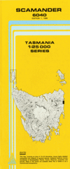
Scamander
Digital Products: You will be forwarded a copy of your digital product via email the following business day.There are no automatic download services available for Tasmap digitial products.
Digital Limitations: Please note that the digital version of these maps DO NOT contain borders, legends, scales, etc. Where a product covers multiple areas, each area is provided as a seperate file. These may not be suitable for use as a print product.
Description
This Topographic Map is produced by the Department of Primary Industries, part of the Tasmanian Government.
These maps are an important resource for Government, industry, and the public. They are used for environmental and emergency management, farm planning and mineral exploration. They are also popular for recreational users such as bushwalkers, mountain bike and horse riders.
The PDF version of this can be printed at home or sent to a professional printer for a 100% scale reproduction.
At this scale, 4cm on this map represents 1km on the ground. A standard map (which is square) covers an area of approximately about 12.5km by 12.5km, with a contour interval of 10m. This map contains natural and constructed features including road and rail infrastructure, vegetation, hydrography, contours, localities and some administrative boundaries.
Glencoe Falmouth Doyles Mudflat Berwyn Falls Devils Creek Ferntree Glen Creek Four Mile Creek Conservation Area Henderson Lagoon Henderson Point Hobkirks Pinnacle Lohreys Creek Manezers Point Mariposa Beach Mariposa Point McIntyre Creek Millstream Arm Peat Marsh Roses Creek Salters Gully St Marys Pass State Reserve Steels Beach Styx Creek Yorkys Creek Devils Creek Bridge Ferntree Glen Ferntree Glen Bridge Ferntree Glen Creek Bridge Salters Gully Creek Bridge Yorkys Creek Bridge Scamander River Fern Tree Glen