
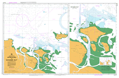
AUS 16
Approaches To Milingimbi Inlet
Please note that all charts are nominally folded in half for storage and handling as per the marine industries standard.
If you require an unfolded copy (ie: flat for framing), please select Flat Paper, and we will organise a special print service to accomodate your request.
Description
This official Nautical Chart is produced by the Australian Hydrographic Office, and corrected fortnightly to 'Notice to Marines' by Cairns Charts & Maps. This ensures it remains compliance with Safety of Navigation requirements. This marine chart, or 'sea map', is primarily produced to support the safe navigation of commercial shipping through Australian, Papua New Guinea and Solomon Island waters.
Nautical charts depict the seabed, or bathymetry, using a variety of colours to shade the depth regions. Darker blues indicate shallower water, while light blues and white indicate deeper water. A chart will also show continuous contour lines (at varying intervals depending on the scale of the chart), 'spot depths' across the whole area, as well as different symbols indicating wrecks, shallow rocks and dangers, as well as details on lights, light houses, tides and currents.
For extensive detail on the symbology of nautical charts, the Symbols and Abbreviations used on Admiralty Charts is the definitive reference.
Milingimbi Bayagida Bennett Creek Bodia Boojiragi Island Cape Stewart Castlereagh Bay Constantine Reefs Crocodile Island Crocodile Island Group Darbada Island Darbilla Creek Djabura Creek Djigagila Creek Durra Island Gananggarngur Island Gumuruguru Gumuruguru Landing Ground Hellier Point Jeayes Reef Mackinnon Point Mardanaingura Island Mewirnbi Milingimbi Airfield Milingimbi Barge Landing Milingimbi Community Education Centre Milingimbi Community Library Milingimbi Health Centre Milingimbi Inlet Milingimbi Island Milingimbi Pre School Mooronga Moorongga Island Landing Ground Mooroongga Island Ngandadauda Creek North Point West Islet Wumila Point Yabooma Island Mjrungga Mjrungga Island Crocodile Islands Rabuma Island Millingimbi Mission Millingimbi Island Milimgimbi Millimgimbi Island