
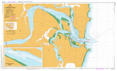
AUS 222
Clarence River
Please note that all charts are nominally folded in half for storage and handling as per the marine industries standard.
If you require an unfolded copy (ie: flat for framing), please select Flat Paper, and we will organise a special print service to accomodate your request.
Description
This official Nautical Chart is produced by the Australian Hydrographic Office, and corrected fortnightly to 'Notice to Marines' by Cairns Charts & Maps. This ensures it remains compliance with Safety of Navigation requirements. This marine chart, or 'sea map', is primarily produced to support the safe navigation of commercial shipping through Australian, Papua New Guinea and Solomon Island waters.
Nautical charts depict the seabed, or bathymetry, using a variety of colours to shade the depth regions. Darker blues indicate shallower water, while light blues and white indicate deeper water. A chart will also show continuous contour lines (at varying intervals depending on the scale of the chart), 'spot depths' across the whole area, as well as different symbols indicating wrecks, shallow rocks and dangers, as well as details on lights, light houses, tides and currents.
For extensive detail on the symbology of nautical charts, the Symbols and Abbreviations used on Admiralty Charts is the definitive reference.
Omore Harwood Iluka Yamba Arris Island Araiel Island Andersons Beach Bakers Island Barri Point The Bluff Bluff Beach Blacks Island Bolorobo Island Clarence Head Collis Wall Convent Beach Dart Island Esk Island Folbigg Point Frazers Reef Freeburn Island Gantry Wall Garden Island Gill Park Goodwood Island Gourd Island Harwood Island Harwood Island Public School Hickey Island Iluka Bay Iluka Beach Iluka Bluff Iluka Nature Reserve Iluka Public School Iluka Rainforest Deadman Islet Fairy Island Flat Rock Harwood Post Office Iluka Rain Forest The Lake Channel Mckittricks Beach Mantzos Island Micalo Channel Micalo Island Middle Wall Moriartys Wall Nanegai Narho Creek Nihill Island Nile Island North Head Orogandiman Island Ounougoman Island Outer South Head Oyster Channel Oyster Creek Palm Channel Palmers Island Palmers Island Public School Palm Island Panibona Island Periko Island Pilot Hill Pippi Beach Rabbit Island Rain Forest Romiaka Channel Romiaka Island Romiako Island Saltwater Inlet Serpentine Channel Shallow Channel Shoal Bay Sleeper Island South Head or Wooli Story Park Syd Gill Park Taloumbi Thorny Island Tomayen Island Turkey Island Turners Beach Ungundam Island Wangainan Island Waringa Island Whiting Beach Whyna Island Wooli Bay Wooli Park Yamba Beach Yamba Channel Yamba Point Yamba Post Office Yamba Public School Doe Island Dot Island Crystal Waters Iluka Reservoir The T Piece James Creek Everson Island Palmer Island Clarence River