
AUS 45
Approaches To Derby
Please note that all charts are nominally folded in half for storage and handling as per the marine industries standard.
If you require an unfolded copy (ie: flat for framing), please select Flat Paper, and we will organise a special print service to accomodate your request.
Description
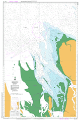
This official Nautical Chart is produced by the Australian Hydrographic Office, and corrected fortnightly to 'Notice to Marines' by Cairns Charts & Maps. This ensures it remains compliance with Safety of Navigation requirements. This marine chart, or 'sea map', is primarily produced to support the safe navigation of commercial shipping through Australian, Papua New Guinea and Solomon Island waters.
Nautical charts depict the seabed, or bathymetry, using a variety of colours to shade the depth regions. Darker blues indicate shallower water, while light blues and white indicate deeper water. A chart will also show continuous contour lines (at varying intervals depending on the scale of the chart), 'spot depths' across the whole area, as well as different symbols indicating wrecks, shallow rocks and dangers, as well as details on lights, light houses, tides and currents.
For extensive detail on the symbology of nautical charts, the Symbols and Abbreviations used on Admiralty Charts is the definitive reference.
Derby Amur Point Black Rocks Christine Point Derby District High School Derby Microwave Repeater Station Derby Regional Hospital Doctors Creek East Doctors Creek West Elbow Shoal Inner Rip Shoal Josephine Point Karmulinunga Community Kimberley School of the Air Mary Island North Mary Island South Numbala Nunga Numbala Nunga Nursing Home Outer Rip Shoal Point Torment Torment Spit Black Rocks Lighthouse Black Rock Nob Hillock North Mary Island North Mary Islet Double Nob Hillock South Mary Island South Mary Islet Fraser River