
AUS 450
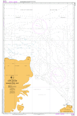
Cape Rouse To Sandefjord Bay
Please note that all charts are nominally folded in half for storage and handling as per the marine industries standard.
If you require an unfolded copy (ie: flat for framing), please select Flat Paper, and we will organise a special print service to accomodate your request.
Description
This official Nautical Chart is produced by the Australian Hydrographic Office, and corrected fortnightly to 'Notice to Marines' by Cairns Charts & Maps. This ensures it remains compliance with Safety of Navigation requirements. This marine chart, or 'sea map', is primarily produced to support the safe navigation of commercial shipping through Australian, Papua New Guinea and Solomon Island waters.
Nautical charts depict the seabed, or bathymetry, using a variety of colours to shade the depth regions. Darker blues indicate shallower water, while light blues and white indicate deeper water. A chart will also show continuous contour lines (at varying intervals depending on the scale of the chart), 'spot depths' across the whole area, as well as different symbols indicating wrecks, shallow rocks and dangers, as well as details on lights, light houses, tides and currents.
For extensive detail on the symbology of nautical charts, the Symbols and Abbreviations used on Admiralty Charts is the definitive reference.
Wild Amery Fram Murray Nella Rim Maris Nunatak Rogers Glacier Tingey Rocks Dodson Rocks Statler Hills Polar Times Glacier Vrana Dome Svarthausen Nunatak Single Island Collins Nunatak Trost Rocks Hargreaves Glacier Mount Caroline Mikkelsen Young Peak Landing Bluff Holder Peak Hamilton Bluff Kista Rock Nickols Island Munro Kerr Mountains Strover Peak Palmer Point Hamm Peak Sansom Islands Bosun Island Sandefjord Bay Landon Promontory Doggers Bay Lars Christensen Coast Amery Ice Shelf Foley Promontory Mechanics Bay Nanok Deep Twilight Bay Mackenzie Bay Lambert Deep Scullin Bank Dingsr Dome Amery Depression Prydz Channel Bjerk Peninsula Flutter Rookery Shallow Bay Point Williams Torlyn Mountain Murray Monolith Cape Rouse Cape Darnley Fram Bank Amery Basin Murray Canyon