
AUS 50
Approaches To Broome
Please note that all charts are nominally folded in half for storage and handling as per the marine industries standard.
If you require an unfolded copy (ie: flat for framing), please select Flat Paper, and we will organise a special print service to accomodate your request.
Description
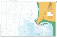
This official Nautical Chart is produced by the Australian Hydrographic Office, and corrected fortnightly to 'Notice to Marines' by Cairns Charts & Maps. This ensures it remains compliance with Safety of Navigation requirements. This marine chart, or 'sea map', is primarily produced to support the safe navigation of commercial shipping through Australian, Papua New Guinea and Solomon Island waters.
Nautical charts depict the seabed, or bathymetry, using a variety of colours to shade the depth regions. Darker blues indicate shallower water, while light blues and white indicate deeper water. A chart will also show continuous contour lines (at varying intervals depending on the scale of the chart), 'spot depths' across the whole area, as well as different symbols indicating wrecks, shallow rocks and dangers, as well as details on lights, light houses, tides and currents.
For extensive detail on the symbology of nautical charts, the Symbols and Abbreviations used on Admiralty Charts is the definitive reference.
Broome Anastasias Pool Beacon Hill Bedford Park Bilgungurr Community Bilingurr Billignuru Bittern Rock Black Ledge Brolga Park Broome Airport Broome Bird Observatory Broome Community Health Services Broome Golf Club Broome Primary School Broome Senior High School Buccaneer Rock Buckleys Bore Burrgugun Community Cable Beach Cable Beach Primary School Cable Beach Reserve Cape Latreille Channel Rock Chippindall Park Cookes Pillar Cygnet Park Dakas Park Dampier Creek Declaration Rock Demco Park Disaster Rock Djugun Duncan Bore East Rock Entrance Point Escape Rocks Fall Point False Saddle Hill Fishermens Bend Gantheaume Point Gantheaume Point Light Goodjara Bore Goolarabooloo Community Inner Anchorage Jarangar Jones Place Kimberley Camp School Kimberley Region Kirby Gardens Lawrence Park Lookout Hill Mackie Park Mallingbar Community Mamabulanjin Community Mangrove Point Maritana Park Mcmahon Reserve Melaleuca Miller Park Minyirr Morrells Park Community Nab Rock Nillir Irbanjin Community North Rock Pearl Shoals Peter Haynes Reserve Pioneer Cemetery Planigale Park Poinciana Well Reactor Lodge Red Hill Red Point Riddell Beach Riddell Point Roebuck Bay Roebuck Bay Golf Club Roebuck Deep Roebuck Primary School Saddle Hill Sam Male Reserve Sayonara Park Sibosado Park Solway Park St Marys College Station Hill Sugar Glider Park Sunset Park Swirl Rock Tagarana Bore Tolentino Park Town Beach Reserve West Roebuck Whale Rock Willagree Park Woods Park Red Bluff Low Point Gantheaume Bay Duncan Well Station Head Paterson Well One Mile Tank Escape Rock Cape Huygens Broome Harbour Beacon Head