Please note that all charts are nominally folded in half for storage and handling as per the marine industries standard.
If you require an unfolded copy (ie: flat for framing), please select Flat Paper, and we will organise a special print service to accomodate your request.
Description
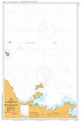
This official Nautical Chart is produced by the Australian Hydrographic Office, and corrected fortnightly to 'Notice to Marines' by Cairns Charts & Maps. This ensures it remains compliance with Safety of Navigation requirements. This marine chart, or 'sea map', is primarily produced to support the safe navigation of commercial shipping through Australian, Papua New Guinea and Solomon Island waters.
Nautical charts depict the seabed, or bathymetry, using a variety of colours to shade the depth regions. Darker blues indicate shallower water, while light blues and white indicate deeper water. A chart will also show continuous contour lines (at varying intervals depending on the scale of the chart), 'spot depths' across the whole area, as well as different symbols indicating wrecks, shallow rocks and dangers, as well as details on lights, light houses, tides and currents.
For extensive detail on the symbology of nautical charts, the Symbols and Abbreviations used on Admiralty Charts is the definitive reference.
Warruwi Goulbourn Island Aerodrome Ainag Point Amatjatpalk Andjarrging Point Angarlban Creek Angularli Creek Anuru Bay Anyiminali Point Ararlagu Armorran Arrla Bay Aurari Bay Barclay Point Bottle Rocks Braithwaite Point Brogden Point Cone Point Cuthbert Point Fletcher Point Gningarg Point Goomadeer River Goulburn Islands Guion Point Hall Point Hogmanay Shoal Iliwan Swamp Injilatparri Junction Bay Jungle Creek King River King River Police Camp Laterite Point Macquarie Strait Madarrgaidj Bay Mangrove Point Manjaroo Swamp Mardbal Bay Marligur Creek Mc Cluer Island Mc Pherson Point McArthur Creek Mount Permain Mullet Bay New Year Island Ngarlu Ngarlu Ngipin Ngurrgu Point North Goulburn Island Omanile Lagoon Ross Point Sand Point Sims Island South Goulburn Island South Goulburn Island Barge Landing South West Bay Turner Point Wa Wu-I Billabong Waminari Waminari Bay Wamirumu Point Wangularni Bay Warruwi Health Centre Warruwi Police Station Warruwi Pre School Warruwi School Wellington Range White Point White Rocks Wigu Wudbud Point Wurugoij Creek New Year Islet Hogmany Shoal McCluer Island McClure Island North Island Billabong Wa Wu-i South Island Wyalla Bay South-West Bay McPherson Point Goulburn Island Mission Goulburn Island Sims Islet Beatrice River Gumadir River Mangrove Bluff Wellington Hills Mount Permair Magari Creek

