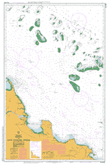
Please note that all charts are nominally folded in half for storage and handling as per the marine industries standard.
If you require an unfolded copy (ie: flat for framing), please select Flat Paper, and we will organise a special print service to accomodate your request.
Description
This official Nautical Chart is produced by the Australian Hydrographic Office, and corrected fortnightly to 'Notice to Marines' by Cairns Charts & Maps. This ensures it remains compliance with Safety of Navigation requirements. This marine chart, or 'sea map', is primarily produced to support the safe navigation of commercial shipping through Australian, Papua New Guinea and Solomon Island waters.
Nautical charts depict the seabed, or bathymetry, using a variety of colours to shade the depth regions. Darker blues indicate shallower water, while light blues and white indicate deeper water.A chart will also show continuous contour lines (at varying intervals depending on the scale of the chart), 'spot depths' across the whole area, as well as different symbols indicating wrecks, shallow rocks and dangers, as well as details on lights, light houses, tides and currents.
For extensive detail on the symbology of nautical charts, the Symbols and Abbreviations used on Admiralty Charts is the definitive reference.
Gainsford Utopia Inkerman The Cape Lisgar Cape View Tabulum Rocky Ponds Coventry Ness Vale Wyoming Woodbine Caley Valley Rangemore Ayr Bowen Home Hill Kalamia Estate Merinda Mirrigan Alva Abbot Abbot Bay Abbot Point Adelaide Point Alligator Lagoon Alma Creek Mount Alma Alva Creek Antill Armstrong Creek Arrow Creek Bald Hill Beach Hill Bells Waterhole Big Jack Creek Big Patterson Island Bobawaba Bobs Creek Bootooloo Bowden Reef Bowling Green Cape Bowling Green Mount Bramston Branch Creek Breakfast Creek Broadhurst Reef Bull Creek Burdekin River Burdekin River Ana Branch Butchers Creek Cabbagetree Creek Caley Valley Waterholes Calton Hill Camp Island Cape Creek Cape Upstart National Park Mount Carew Carstairs Castor Reef Charity Reef Charlies Hill Chyebassa Shoal Clark Shoal Coconut Bay Crotan Reef Curlewis Curlewis Bay Mount Curlewis Dalrymple Point Darley Reef Datum Rock Davies Reef Deep Creek Delta Port Denison Dillon Creek Mount Dillon Don Don Creek Don River Double Mountain Doughty Creek Duck Creek Durroburra Eagle Reef Edgecumbe Heights Cape Edgecumbe Edinburgh Castle Elliot River Euri Euri Creek Faith Reef Finley Creek Flagstaff Bay Flagstaff Hill Flying Fox Island Four Mile Creek Four Mile Lagoon Gates Creek Glen Blazes Creek Goodbye Creek Gordon Creek Mount Gordon Greentop Creek Mount Greentop Groper Creek Gumlu Guthalungra Hall Reef Hay Gully Heath Creek Herbert Heronvale Holbourne Island Horseshoe Bay Mount Inkerman Iyah Jack Creek Jupiter Reef Kaili Kalamia Kalamia Creek Kangaroo Creek Keebah Kelsey Kilbogie Kings Beach Kyburra Leichhardt Creek Lilliesmere Lagoon Lilliesmere Swamp Little Sugarloaf Creek Mount Little Long Waterhole Mount Luce Lynchs Beach Macdonald Creek Magnetic Creek Maiden Creek Maria Creek Mathers Lagoon McCanes Bay Merryplain Creek Mid Reef Middle Hill Middle Island Middle Landing Mine Island Molongle Molongle Creek Moosie Hill Morinda Shoal Morrill Mother Beddick Mount Nutt Waterholes Mount Stuart Creek Mud Creek Mullers Lagoon Murray Bay Nares Rock Nobbies Inlet Nobbies Lookout North Entrance North Head North Rock Nulla Waterhole Mount Nutt Old Reef Peters Island Plain Creek Plantation Creek Pocket Police Camp Creek Pollux Reef Prawn Reef Pring Mount Pring Queens Bay Queens Beach R M Creek R M Point Reno Bay Rita Island Rocky Ponds Creek Rose Bay Roundback Mount Roundback Russell Island Salisbury Salisbury Plains Saltwater Creek Saltwater Creek Left Branch Sandy Creek Seaforth Creek Shark Bay Sheep Station Creek Shell Reef Shoalwater Bay Shrimp Reef Sinclair Head Six Mile Creek Slater Creek Snug Harbour South Entrance South Head Split Creek Splitters Creek Spring Creek Sprole Castle Stanley Reef Station Hill Stone Island Stoney Creek Sugarloaf Creek Summer Hill Tabias Reef Tabletop Creek The Green Swamp The Lake The Lake Plain The Maiden Mountain The Seven Sisters Thomas Island Three Dinner Creek Tink Shoal Tondara Two Mile Creek Upstart Upstart Bay Cape Upstart Viper Reef Wakala Walschs Crossing Wangaratta Creek Washpool Lagoon Wathana Wentworth Rocks Wheeler Reef White Topped Rock Mount Williams Wilmington Wilson Creek Wilson Shoal Winter Shoal Woonton Vale Yellow Gin Creek Yumbabullo Parkside Badilla Berdaje Broadlands Koberinga Koolkuna Marali Abbott Bay Resources Reserve Holbourne Island National Park Flinders Passage Greys Bay Fredericksfield Jarvisfield McDesme Rangemore Burdekin Shire Wangaratta Wunjunga Banfield Reef South Saville-Kent Reef Judith Wright Reef Anniversary Group Airdmillan Fork Reef Cup Reef Grub Reef Spoon Reef Saucer Reef Chicken Reef Centipede Reef Lynchs Reef Lion Reef Croton Reef Pollnx Reef Tobias Reef Pakhoi Bank Flying Fox Islet Ana Branch Burdekin River Northern Branch of Burdekin River Big Paterson Island Holborne Island Wickham R. M. Creek Bobawaba Station Rocky Pond Creek Molonglo Creek Mount Esk Beaks Mountain Inveroona Inverncoona Mount Nuts Don Hill Mount Mother Beddick Camp Creek Alligator Lagoons Bowen Hill Town Hill Shoal Water Bay Knobbies Castleview Port of Bowen Teatree Creek Castle Edinburgh

